Every successful mineral exploration project begins with one critical question: where should we drill? Drilling provides the most direct evidence of mineralization, but it is also one of the most expensive stages of exploration. Before committing significant resources to a drilling program, exploration companies need reliable subsurface information that reduces uncertainty and improves confidence in target selection. This is where a CSAMT Survey becomes an invaluable exploration tool.
A CSAMT Survey (Controlled Source Audio-frequency Magnetotellurics Survey) is a geophysical method used to map underground geological structures by measuring variations in electrical resistivity. Rather than detecting minerals directly, it reveals geological features that commonly control mineralization, including faults, hydrothermal alteration zones, fracture systems, and intrusive contacts.
However, a CSAMT Survey is not the right solution for every exploration project. Like any geophysical method, its effectiveness depends on the exploration objectives, geological setting, and the depth of the target.
This guide explains when a CSAMT Survey should be used, the types of exploration projects where it provides the greatest value, and how it fits into modern mineral exploration workflows, particularly within Indonesia’s diverse geological environment.
What Makes a CSAMT Survey Valuable?
Modern mineral exploration relies on collecting multiple sources of geological information before drilling begins.
Geological mapping reveals surface rock types and structures. Geochemical sampling identifies anomalous mineral concentrations. Magnetic surveys provide insights into magnetic rock units. Each method contributes important information, but none can fully explain what lies beneath the surface.
A CSAMT Survey fills this knowledge gap by imaging subsurface resistivity over depths ranging from several tens of meters to approximately 1-2 kilometers, depending on geological conditions and survey design.
Because different rock types conduct electricity differently, the survey produces detailed resistivity models that help geologists interpret underground geological structures. These structures often represent the pathways through which mineralizing fluids traveled, making them valuable indicators for exploration.
Rather than replacing geological mapping or drilling, a CSAMT Survey strengthens exploration decisions by reducing geological uncertainty before significant investments are made.
Where Does a CSAMT Survey Fit in the Exploration Process?
One of the most common misconceptions is that a CSAMT Survey is the first step in an exploration program.
In reality, it is typically performed after preliminary geological investigations have already identified an area of interest.
A modern mineral exploration workflow often follows this sequence:
- Desktop geological study
- Remote sensing and satellite imagery
- Geological mapping
- Geochemical sampling
- Magnetic or gravity survey
- CSAMT Survey
- Induced Polarization (IP) Survey, if required
- Diamond core drilling
- Resource evaluation
By the time a CSAMT survey is conducted, exploration teams usually have enough regional information to focus on understanding deeper geological structures before drilling begins.
When Should You Use a CSAMT Survey?
Although every exploration project is different, there are several situations where a CSAMT Survey provides significant advantages.
Before Planning an Expensive Drilling Program
One of the most common applications of a CSAMT Survey is reducing drilling uncertainty.
Exploration drilling is expensive, and drilling poorly defined targets can significantly increase project costs without producing meaningful geological information.
By imaging subsurface resistivity before drilling, CSAMT helps identify structural features that may indicate favorable mineralization. This allows exploration teams to prioritize drill targets based on geological evidence rather than surface observations alone.
Instead of replacing drilling, the survey helps ensure drilling is directed toward the most prospective areas.
When Mapping Hydrothermal Alteration
Many economically important mineral deposits form through hydrothermal processes that alter surrounding rocks.
These alteration zones often exhibit different electrical resistivity than unaltered host rocks.
A CSAMT Survey is particularly useful for identifying:
- Silicification
- Argillic alteration
- Propylitic alteration
- Conductive clay zones
Because these alteration patterns commonly occur around porphyry copper-gold and epithermal gold systems, mapping resistivity variations provides valuable guidance during exploration.
When Identifying Faults and Structural Controls
Geological structures frequently control the movement of mineralizing fluids.
Faults, fractures, and shear zones often serve as pathways through which hydrothermal fluids circulate before depositing valuable minerals.
A CSAMT Survey can image these structures even when they are concealed beneath weathered materials or volcanic deposits.
For exploration projects targeting structurally controlled mineralization, understanding these underground features is often more important than simply identifying surface geology.
When Exploring Beneath Thick Weathered Cover
Indonesia’s tropical climate creates extensive weathering profiles that can obscure bedrock geology.
In many parts of Sumatra, Sulawesi, Papua, and Nusa Tenggara, valuable geological structures are hidden beneath thick soil, lateritic cover, or volcanic deposits.
Surface mapping alone may not provide sufficient information about the underlying geology.
A CSAMT Survey allows exploration teams to image geological structures beneath this weathered cover, improving confidence in target generation before drilling begins.
When Investigating Large Exploration Areas
Compared with some shallow geophysical methods, a CSAMT Survey provides efficient coverage across relatively large exploration areas.
Its combination of greater investigation depth and regional coverage makes it particularly useful during intermediate exploration stages where multiple potential targets require evaluation before detailed drilling programs begin.
Key Applications of CSAMT Survey in Indonesia
Indonesia’s geological diversity makes CSAMT Survey technology applicable across several exploration sectors.
Gold Exploration
Gold deposits in Indonesia are frequently associated with hydrothermal systems and structural controls.
Researchers working in the Pongkor–Bayah region of West Java successfully combined CSAMT Survey with Induced Polarization (IP) to identify silicification, breccia zones, and intrusive bodies associated with gold mineralization. [1]
This demonstrates how resistivity imaging can support drill target generation in structurally complex exploration environments.
Copper Exploration
Porphyry copper-gold systems commonly develop around intrusive bodies and extensive hydrothermal alteration.
Because these geological features often produce measurable resistivity contrasts, a CSAMT Survey helps exploration teams identify alteration halos and structural boundaries before drilling.
This approach is particularly valuable in Indonesia, where major porphyry systems occur in regions such as Papua and Nusa Tenggara.
Supporting Integrated Exploration Programs
Modern exploration rarely depends on a single geophysical method.
Instead, CSAMT Survey is commonly integrated with geological mapping, geochemical sampling, magnetic surveys, Induced Polarization, and drilling.
Each dataset contributes unique geological information, allowing exploration teams to develop a more complete understanding of the subsurface.
This integrated approach reduces exploration risk while improving confidence in geological interpretation.
When a CSAMT Survey May Not Be the Best Choice
Although a CSAMT Survey is highly effective for many exploration projects, it is not suitable for every situation.
Projects focusing on shallow investigations may benefit more from other geophysical methods.
For example, Electrical Resistivity Tomography (ERT) is often preferred for:
- Nickel laterite profiling
- Groundwater investigations
- Engineering geology
- Foundation studies
- Environmental assessments
ERT produces exceptionally detailed images of shallow geological conditions, making it ideal when exploration targets occur close to the surface.
Similarly, if the objective is to investigate extremely deep crustal structures or regional geothermal systems extending many kilometers below ground, a natural-source Magnetotelluric (MT) survey may provide greater penetration depth.
Choosing the appropriate geophysical method should always be based on exploration objectives rather than assuming one technology is universally superior.
How Puncakbaru Jayatama Supports Mineral Exploration
Every exploration project presents unique geological challenges that require careful planning, appropriate survey selection, and reliable field data. At Puncakbaru Jayatama (PTPJ), CSAMT Survey services are designed to support mineral exploration projects requiring reliable subsurface resistivity imaging for geological interpretation and drill target generation.
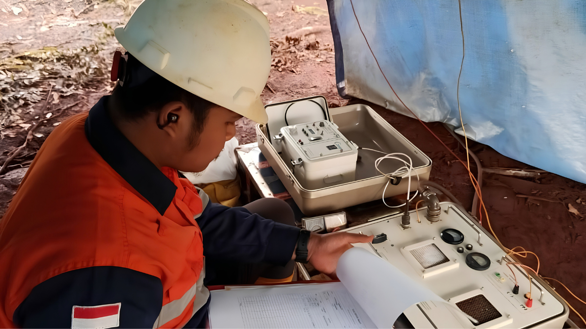
To support CSAMT data acquisition, PTPJ utilizes Zonge geophysical equipment and technology systems, providing a specialized platform for controlled-source electromagnetic measurements in mineral exploration environments. The equipment supports the collection of resistivity and related electromagnetic data that can be interpreted to help characterize subsurface geological conditions.
By integrating CSAMT data with geological mapping, geochemical investigations, drilling programs, and complementary geophysical methods, exploration teams can gain a clearer understanding of underground geological conditions while reducing exploration uncertainty. Rather than functioning as a standalone solution, PTPJ’s approach emphasizes integrating multiple exploration datasets to support informed decision-making throughout the exploration process.
This keeps the focus on what CSAMT does and why it matters, while giving readers a concrete indication of the technology PTPJ uses to deliver the service.
Frequently Asked Questions
When should you use a CSAMT Survey?
A CSAMT Survey is most beneficial when exploration projects require detailed imaging of geological structures before drilling, particularly for mineral exploration, hydrothermal alteration mapping, fault interpretation, and geothermal investigations.
Can a CSAMT Survey detect gold directly?
No. A CSAMT Survey measures underground electrical resistivity rather than detecting specific minerals. It identifies geological conditions commonly associated with mineralization, helping geologists prioritize drilling locations.
How deep can a CSAMT Survey investigate?
Depending on geological conditions and survey design, a CSAMT Survey typically investigates from several tens of meters to approximately 1-2 kilometers beneath the surface.
Is a CSAMT Survey suitable for nickel exploration?
It depends on the exploration objective. For shallow nickel laterite deposits, Electrical Resistivity Tomography (ERT) is often more appropriate. However, a CSAMT Survey can complement ERT when deeper geological structures or bedrock interpretation are required.
Can a CSAMT Survey be combined with other exploration methods?
Yes. Modern exploration programs commonly integrate CSAMT Survey with geological mapping, magnetic surveys, geochemical sampling, Induced Polarization, and drilling to develop a more comprehensive geological model.
Conclusion
A CSAMT Survey has become one of the most valuable geophysical methods for modern mineral exploration because it helps bridge the gap between surface observations and drilling decisions.
Its ability to image geological structures, hydrothermal alteration, and resistivity variations hundreds of meters to several kilometers beneath the surface makes it particularly effective for gold, copper, geothermal, and structurally controlled exploration projects.
At the same time, understanding when not to use CSAMT is equally important. Shallow exploration objectives such as nickel laterite profiling or engineering investigations may be better served by Electrical Resistivity Tomography, while deeper regional studies may require Magnetotelluric surveys.
Ultimately, the most successful exploration programs select geophysical methods based on geological objectives and integrate multiple datasets to build a complete understanding of the subsurface before drilling begins.
Explore Your Project with PTPJ’s CSAMT Survey Services
If your exploration program requires detailed subsurface information before drilling, Puncakbaru Jayatama (PTPJ) provides professional CSAMT Survey services tailored to Indonesia’s complex geological environments.
Our experienced geophysical team helps mining and exploration companies generate reliable resistivity data, improve geological interpretation, and support more confident exploration decisions through integrated geophysical solutions. Contact PTPJ today to learn how a CSAMT Survey can strengthen your next mineral exploration project.
Source:
[1] Kholilur Rahman, Syamsurijal Rasimeng, and Nandi Haerudin, “Identifikasi Zona Mineralisasi Emas Berdasarkan Data Controlled Source Audio-Frequency Magnetotellurics (CSAMT) dengan Data Pendukung Induced Polarization (IP) di Lapangan AU,” Jurnal Geofisika Eksplorasi, vol. 3, no. 1 (2017), pp. 3–15, available via Academia.edu, https://www.academia.edu/66750298/Identifikasi_Zona_Mineralisasi_Emas_Berdasarkan_Data_Controlled_Source_Audio_Frequency_Magnetotellurics_Csamt_Dengan_Data_Pendukung_Induced_Polarization_Ip_DI_Lapangan_Au.