
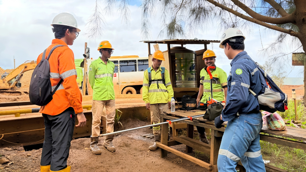
Understanding subsurface geology is a fundamental requirement in mineral exploration. While geological mapping can document rocks, structures, alteration, and mineral occurrences exposed at the surface, significant portions of a geological system may remain concealed beneath soil, vegetation, weathered profiles, sediment, or younger rock formations.
Geophysical Exploration Services provide an indirect means of investigating these concealed geological conditions by measuring physical properties of the Earth. Depending on the exploration objective, geophysical surveys can provide information about magnetic susceptibility, electrical resistivity, chargeability, density, and other physical characteristics that contribute to geological interpretation.
Modern Exploration Mining therefore involves more than selecting a single geophysical technique. Geological mapping, geochemical sampling, remote sensing, geophysical surveys, exploration drilling, laboratory analysis, and geological modelling can be integrated to progressively develop and test a geological interpretation.
The role of geophysics within this process is not to directly confirm an economic mineral deposit. Instead, geophysical data can identify physical-property contrasts and subsurface features that may be relevant to mineral systems and can help define areas for further investigation.
This distinction is important because geophysical responses are generally non-unique. A particular anomaly may have several possible geological explanations, and its significance depends on the geological setting, survey design, data quality, processing, and interpretation.
In Indonesia, where exploration projects can involve complex volcanic, intrusive, tectonic, and deeply weathered environments, appropriately selected geophysical methods can provide valuable information where surface observations alone are insufficient.
This article examines the principal types of Geophysical Exploration Services, their role in mineral exploration, and the factors that should be considered when selecting and integrating geophysical survey methods.
What Are Geophysical Exploration Services?
Geophysical Exploration Services are professional technical investigations that measure physical properties of the Earth to characterize and interpret subsurface geological conditions.
Unlike geological mapping, which primarily examines rocks and structures exposed at the surface, geophysical surveys acquire measurements that provide indirect information about geological features below the surface without requiring extensive excavation or drilling across the entire area.
Different geophysical techniques measure different physical properties. Magnetic surveys investigate variations in the Earth’s magnetic field, gravity surveys measure variations related to subsurface density, and electrical and electromagnetic methods investigate properties associated with conductivity and resistivity. Induced Polarization (IP) surveys additionally examine the chargeability response of subsurface materials.
Within Exploration Mining, these measurements can contribute to the interpretation of lithological boundaries, structural features, intrusive bodies, alteration zones, basin geometry, and other geological characteristics.
Geophysical data, however, should not be interpreted independently of geological context. Because different geological sources can produce similar geophysical responses, interpretation generally requires integration with geological mapping, geochemistry, existing exploration data, and where appropriate, drilling results.
Why Geophysical Exploration Services Matter
A significant portion of the geology relevant to mineral exploration may not be directly observable at the surface.
Geophysical surveys provide an additional source of subsurface information that can complement geological and geochemical investigations. Depending on the method and survey design, they may help exploration teams:
- Characterize geological structures and physical-property contrasts.
- Extend geological interpretation beneath areas of limited surface exposure.
- Identify anomalies requiring further investigation.
- Contribute to exploration target generation.
- Provide information relevant to drill planning.
- Support two-dimensional and three-dimensional geological modelling.
The value of geophysics lies primarily in its ability to provide information that cannot be obtained from surface observations alone.
It is important to distinguish between geophysical anomaly identification and mineral deposit confirmation. A geophysical anomaly represents a measurable physical-property response. Determining whether that response is related to mineralization requires geological interpretation and, where warranted, direct investigation through drilling and sampling.
Geophysical surveys therefore contribute to exploration risk management by improving the information available for geological decision-making, but they do not eliminate geological or economic uncertainty.
Common Types of Geophysical Exploration Services
Modern Exploration Mining uses a range of geophysical techniques, with each method selected according to the physical properties and geological characteristics relevant to the exploration objective.
Drone Magnetic Surveys
Drone Magnetic Surveys use unmanned aerial vehicles equipped with magnetometers to measure variations in the Earth’s magnetic field across a defined survey area.
Magnetic responses are influenced by differences in the magnetic properties of geological materials. The resulting data can contribute to the interpretation of:
- Lithological boundaries.
- Magnetic domains.
- Fault and shear zones.
- Intrusive bodies.
- Structural trends.
- Regional geological architecture.
UAV-based magnetic acquisition can be particularly useful where detailed spatial coverage is required or where rugged terrain, vegetation, or limited ground access presents challenges for conventional ground-based surveying.
Survey design is an important consideration. Flight altitude, line spacing, terrain clearance, positioning accuracy, sensor specifications, and UAV magnetic interference can all influence data quality and spatial resolution.
Magnetic data may also require correction for temporal variations in the Earth’s magnetic field, cultural magnetic sources, and other acquisition effects before interpretation.
The resulting anomalies must be evaluated within the geological framework. Magnetic data indicate variations in magnetic properties; they do not directly identify an orebody or establish the economic significance of mineralization.
CSAMT Surveys
Controlled Source Audio-frequency Magnetotelluric (CSAMT) Surveys are electromagnetic investigations that use a controlled source to characterize variations in subsurface electrical resistivity.
Electrical resistivity can vary according to lithology, porosity, fluid content, alteration, mineral content, and other geological conditions. These variations can produce resistivity contrasts that contribute to the interpretation of subsurface structures.
Depending on the geological setting, CSAMT data may assist in investigating:
- Fault and fracture systems.
- Resistivity contrasts between geological units.
- Alteration-related zones.
- Conductive or resistive structures.
- Subsurface geological boundaries.
CSAMT can be particularly useful when exploration objectives require information about subsurface resistivity beyond what can be established through surface geological observations.
However, depth of investigation and resolution are not fixed characteristics of the method. They depend on factors such as survey configuration, source-receiver geometry, geological conditions, background electromagnetic noise, data quality, and inversion methodology.
For this reason, CSAMT results should be interpreted together with geological and other geophysical information rather than treated as a direct indicator of mineralization.
Gravity Surveys
Gravity Surveys measure variations in the Earth’s gravitational field associated with differences in subsurface density.
Because different rocks and geological bodies can have different densities, gravity data can contribute to the interpretation of regional and local geological architecture.
Typical applications may include investigation of:
- Basin geometry.
- Major geological boundaries.
- Regional structural architecture.
- Dense intrusive bodies.
- Large-scale subsurface density variations.
Gravity surveys are particularly relevant when the exploration objective involves broader geological structures or density contrasts.
The interpretation of gravity data is inherently non-unique. Similar gravity responses can be generated by different combinations of source density, geometry, depth, and distribution. Terrain corrections, station spacing, measurement accuracy, and processing methodology therefore have an important influence on interpretation.
Induced Polarization (IP) Surveys
Induced Polarization (IP) Surveys measure the electrical chargeability of subsurface materials and are commonly acquired alongside resistivity measurements.
Chargeability responses can be associated with disseminated metallic minerals, particularly certain sulfide mineral assemblages. As a result, IP has applications in exploration programs investigating mineral systems such as porphyry copper, epithermal, and volcanogenic massive sulfide environments.
Potential exploration applications include:
- Investigation of disseminated sulfide mineralization.
- Porphyry-style mineral systems.
- Epithermal mineral systems.
- Volcanogenic massive sulfide environments.
- Other geological settings where chargeability contrasts are considered relevant.
However, chargeability is not uniquely diagnostic of sulfide mineralization. Clay-rich materials, geological interfaces, and other subsurface conditions can also generate chargeability responses.
IP data are therefore generally interpreted together with resistivity, geology, geochemistry, and other available evidence.
Electrical Resistivity Tomography (ERT)
Electrical Resistivity Tomography (ERT) measures subsurface electrical resistivity using electrode arrays and can produce two-dimensional or three-dimensional representations of resistivity variations depending on the survey configuration.
ERT is generally applied to relatively shallow investigations and can be used across mineral exploration, engineering geology, groundwater, and environmental applications.
Within exploration programs, ERT may contribute to:
- Near-surface geological characterization.
- Weathering-profile investigations.
- Laterite-related studies.
- Identification of shallow geological contacts.
- Investigation of fractures and structures.
- Characterization of near-surface resistivity variations.
ERT typically provides more detailed information over shallow sections than methods designed for deeper regional investigation. Actual depth of investigation and resolution depend on electrode spacing, array configuration, ground conditions, resistivity contrasts, and inversion methodology.
Magnetotelluric (MT) Surveys
Magnetotelluric (MT) Surveys use naturally occurring variations in electromagnetic fields to investigate subsurface electrical resistivity.
Unlike CSAMT, which uses a controlled electromagnetic source, MT relies primarily on naturally occurring electromagnetic fields associated with atmospheric and ionospheric processes.
MT can provide information about deeper subsurface resistivity structures and is therefore relevant to regional exploration programs where the geological objective extends to greater depths.
Potential applications include:
- Regional geological structure.
- Deep resistivity architecture.
- Large-scale tectonic features.
- Deep conductive or resistive zones.
- Geological systems extending beneath significant cover.
As with other electromagnetic methods, MT interpretation is influenced by survey configuration, electromagnetic noise, geological complexity, data quality, and inversion assumptions.
How Geophysical Surveys Support Drill Targeting
One of the principal applications of Geophysical Exploration Services is their contribution to exploration target evaluation and drill planning.
Drilling targets are generally developed from a geological interpretation rather than from an isolated geophysical anomaly.
An exploration program may begin with regional geological information and surface mapping, followed by geochemical sampling and appropriate geophysical investigations. The resulting datasets can then be integrated to develop and test geological hypotheses.
A simplified exploration workflow may include:
- Regional geological assessment.
- Geological mapping and structural interpretation.
- Geochemical investigation.
- Geophysical surveying.
- Data processing and interpretation.
- Exploration target generation and ranking.
- Drill planning.
- Exploration drilling.
- Geological logging and laboratory analysis.
- Geological model refinement.
The actual sequence varies between projects. Some programs may undertake geophysical surveys early in the exploration process, while others may use drilling results to refine subsequent geophysical investigations.
The key principle is that geophysical information contributes to the evidence base used to evaluate a target. It does not independently determine whether a drillhole will intersect economically significant mineralization.
How Geophysical Surveys Contribute to Exploration Risk Management
Mineral exploration involves geological, technical, operational, financial, and other forms of uncertainty.
Geophysical surveys can contribute to managing certain aspects of this uncertainty by providing additional information about subsurface conditions.
Geological Uncertainty
Geophysical data can extend geological interpretation beyond exposed surface geology and provide information about structures, lithological contrasts, and other physical-property variations.
This can be particularly valuable where mineralization or its host geology is concealed beneath transported material, weathered zones, vegetation, or other cover.
Drilling and Financial Considerations
Exploration drilling can represent a significant portion of an exploration budget. Geophysical information can contribute to target evaluation and drill planning by helping define geological hypotheses that can subsequently be tested through drilling.
However, geophysics does not guarantee successful drilling. A drillhole may intersect mineralization, encounter a different geological environment than expected, or provide information that requires the geological model to be revised.
In this sense, drilling is not simply a confirmation exercise. It is a method of testing geological interpretations with direct subsurface evidence.
Operational Considerations
Geophysical surveys can also contribute to exploration planning by providing information that helps determine where more detailed investigation may be warranted.
Survey design itself requires consideration of terrain, accessibility, line orientation, station spacing, flight parameters, environmental conditions, cultural interference, and other operational factors.
Environmental Considerations
Because geophysical methods generally investigate physical properties without extensive excavation, they can be suitable for certain exploration environments where minimizing ground disturbance is an important consideration.
Where geophysical information helps prioritize areas for subsequent investigation, the exploration program may be able to concentrate more intensive activities within selected areas.
Nevertheless, environmental impact depends on the specific survey method, access requirements, equipment, site conditions, and regulatory requirements. Geophysics should therefore be incorporated into a broader environmental and operational management framework.
Why Multiple Geophysical Methods May Be Used Together
No single geophysical technique provides a complete representation of subsurface geology.
Each method measures a different physical property:
- Magnetic surveys investigate variations in magnetic properties.
- CSAMT investigates electrical resistivity using a controlled electromagnetic source.
- Gravity surveys investigate density contrasts.
- IP surveys investigate chargeability and commonly resistivity.
- ERT provides detailed information about near-surface resistivity.
- MT investigates naturally occurring electromagnetic responses and can contribute to deeper resistivity interpretation.
The purpose of combining methods is not simply to generate more data. Different methods can be selected because they respond to different geological characteristics.
For example, magnetic data may help interpret lithological and structural variations, while resistivity information may provide a different perspective on alteration, fluid-related features, or geological boundaries. Where these datasets can be reconciled within a geological model, they may provide complementary evidence.
Importantly, integration can also reveal inconsistencies.
If two datasets produce responses that cannot be readily explained by the current geological interpretation, this may indicate that the model requires further investigation or revision.
Multi-method geophysics is therefore most valuable when it is designed around specific geological questions and interpreted within a coherent geological framework.
Geophysical Exploration in Indonesia
Indonesia contains diverse geological environments associated with mineral systems and commodities including nickel, copper, gold, tin, bauxite, and others.
The country’s geological setting includes volcanic arcs, intrusive complexes, ultramafic and ophiolitic terrains, sedimentary basins, and complex structural systems. These environments can produce significant variations in the physical properties measured by geophysical techniques.
At the same time, Indonesian exploration projects frequently encounter operational conditions that influence survey design and field execution. Dense vegetation, tropical weathering, rugged terrain, remote locations, limited infrastructure, and variable ground conditions can affect geological mapping, geophysical acquisition, equipment access, and drilling logistics.
For example, terrain and vegetation may influence UAV flight planning for magnetic surveys, while weathered or heterogeneous near-surface materials can affect electrical and electromagnetic measurements.
Consequently, geophysical survey selection should account for both the geological objective and the practical characteristics of the exploration area.
Exploration activities must also be undertaken in accordance with applicable Indonesian regulations, licensing requirements, environmental provisions, safety requirements, and relevant technical standards.
Choosing the Right Geophysical Exploration Service
There is no universally superior geophysical method. The appropriate technique depends on the geological question, physical-property contrast, exploration stage, and project requirements.
Important considerations include:
- Exploration objective.
- Commodity and deposit model.
- Geological environment.
- Expected physical-property contrasts.
- Target depth.
- Required spatial resolution.
- Existing geological and exploration data.
- Terrain and accessibility.
- Background noise and cultural interference.
- Survey area and logistics.
- Project budget and schedule.
The selection process should begin with the geological problem rather than the technology itself.
For example, an exploration program investigating magnetic lithological contrasts may consider a magnetic survey, while a program focused on subsurface resistivity architecture may consider CSAMT, ERT, or MT depending on the required depth and survey scale.
In other cases, multiple methods may be appropriate because the geological interpretation requires information from more than one physical-property domain.
The objective is to select the methods capable of generating meaningful information for the geological questions being investigated.
How Puncakbaru Jayatama Supports Exploration Mining
Puncakbaru Jayatama (PTPJ) provides technical services supporting mineral exploration programs, including geophysical surveying, geological investigation, and exploration drilling.
Its exploration capabilities include Drone Magnetic Surveys, CSAMT Surveys, geological investigation and interpretation, and professional diamond core drilling, with the scope of work determined according to individual project requirements.
These services address different components of the exploration workflow. Drone Magnetic Surveys can provide information about magnetic variations and geological structures, while CSAMT can contribute to the interpretation of subsurface resistivity. Exploration drilling can then provide direct geological information that is evaluated alongside geophysical interpretations.
The appropriate combination depends on factors including the geological setting, exploration stage, target characteristics, terrain, survey objectives, and information required for subsequent decision-making.
PTPJ’s role is to support the technical execution of exploration activities according to the defined scope, field conditions, and geological objectives of each project.
Frequently Asked Questions
What are Geophysical Exploration Services?
Geophysical Exploration Services are technical investigations that measure physical properties of the Earth to characterize subsurface geological conditions. Depending on the exploration objective, methods may include magnetic, gravity, electrical, electromagnetic, induced polarization, resistivity, and magnetotelluric surveys.
Why are geophysical surveys used before drilling?
Geophysical surveys can provide information about subsurface physical-property contrasts, geological structures, and other features that may not be visible at the surface. This information can contribute to exploration target evaluation and drill planning.
Can geophysical surveys identify mineral deposits?
Geophysical surveys can identify anomalies and physical-property contrasts that may be associated with geological features or mineralization. However, geophysical responses are generally non-unique and do not independently establish the presence, grade, continuity, or economic significance of a mineral deposit. Direct investigation through drilling and sampling may be required.
Which geophysical survey method is best?
There is no universally best geophysical survey method. Selection depends on the geological objective, commodity, deposit model, expected physical properties, target depth, terrain, existing data, and required spatial resolution.
What is the difference between Drone Magnetic and CSAMT Surveys?
Drone Magnetic Surveys measure variations in the Earth’s magnetic field and can contribute to the interpretation of magnetic geological contrasts and structural features. CSAMT uses a controlled electromagnetic source to investigate subsurface electrical resistivity. Because they measure different physical properties, the two methods can provide complementary information when appropriate to the geological setting.
Why are multiple geophysical methods used together?
Different geophysical methods respond to different physical properties. Combining appropriate methods can provide complementary evidence for evaluating geological interpretations. The value of integration depends on the relevance and quality of the datasets and their relationship to the geological model.
Are geophysical surveys a replacement for drilling?
No. Geophysical surveys provide indirect information about subsurface physical properties, whereas drilling provides direct geological samples or drilling products from depth. The two methods serve different purposes and are frequently used as complementary components of an exploration program.
Conclusion
Geophysical Exploration Services provide an important source of subsurface information within modern mineral exploration.
Magnetic, electrical, electromagnetic, gravity, and induced polarization methods investigate different physical properties of the Earth. Their results can contribute to the interpretation of lithological boundaries, geological structures, alteration, density contrasts, resistivity variations, and other features relevant to mineral systems.
The effectiveness of geophysics depends on how appropriately the survey method is selected, designed, acquired, processed, and interpreted. Geological mapping, geochemistry, remote sensing, geophysics, drilling, laboratory analysis, and geological modelling each provide different forms of evidence that can be progressively integrated throughout an exploration program.
Geophysical surveys can contribute to target generation and drill planning, but they do not independently confirm economically significant mineralization. Geological interpretation and direct subsurface investigation remain essential when evaluating exploration hypotheses.
For projects in Indonesia, survey design must also account for geological complexity, weathering, terrain, vegetation, accessibility, field logistics, regulatory requirements, safety, and environmental considerations.
Effective geophysical exploration therefore begins with a clearly defined geological question. The appropriate method—or combination of methods—can then be selected according to the physical properties expected to provide useful information about that question.
Geophysical Exploration Services from PTPJ
Puncakbaru Jayatama (PTPJ) supports mineral exploration programs through geophysical and exploration services including Drone Magnetic Surveys, CSAMT Surveys, geological investigation and interpretation, and professional diamond core drilling.
The appropriate scope of work depends on the project’s geological setting, exploration stage, target characteristics, survey objectives, and technical requirements.
For exploration teams evaluating mineral prospects in Indonesia, appropriately designed geophysical surveys can provide an additional source of subsurface information to support geological interpretation, target evaluation, and subsequent exploration planning.