
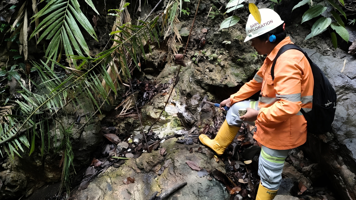
Every mineral deposit tells a geological story. While some deposits are exposed at the surface, many of the world’s most valuable mineral resources remain hidden beneath soil, vegetation, weathered rock, or sediment. For mining companies, discovering these concealed deposits requires more than visual observation—it requires scientific methods capable of detecting subtle clues left behind by geological processes. This is where Geochemical Exploration Services become an essential part of modern Exploration Mining.
Geochemistry is the study of the distribution and concentration of chemical elements within the Earth. In mineral exploration, geochemical surveys analyze natural materials such as soil, rocks, stream sediments, and drill core samples to identify chemical anomalies that may indicate hidden mineralization. Even when an ore body is buried beneath hundreds of meters of cover, weathering and geological processes can leave detectable geochemical signatures at the surface.
However, geochemistry alone cannot confirm the presence of an economically viable mineral deposit. Like geological mapping and geophysical surveys, it is one piece of a larger exploration strategy. The greatest value of Exploration Mining comes from integrating geological observations, geochemical data, geophysical investigations, and drilling into a comprehensive geological model that supports informed exploration decisions.
In Indonesia, where tropical weathering, dense vegetation, and complex geological settings often conceal mineral deposits, geochemical exploration plays an especially important role in identifying promising exploration targets before drilling begins.
This article explores what Geochemical Exploration Services involve, how they support Exploration Mining, and why geochemistry remains one of the most valuable tools for discovering hidden mineral deposits.
What Are Geochemical Exploration Services?
Geochemical Exploration Services are professional technical investigations that collect and analyze natural materials to identify chemical signatures associated with mineralization. Unlike geological mapping, which studies visible rock formations, or geophysical surveys, which measure the Earth’s physical properties, geochemistry focuses on the concentration and distribution of chemical elements within different sample types. Common exploration samples include:
- Soil
- Rock chips
- Stream sediments
- Lateritic materials
- Drill core samples
- Water samples (for selected exploration programs)
The purpose of geochemical exploration is to identify areas where element concentrations differ significantly from natural background levels. These geochemical anomalies may indicate geological processes capable of forming economically valuable mineral deposits. Rather than directly locating ore bodies, geochemistry helps exploration teams identify areas that deserve more detailed geological investigation.
Why Geochemistry Matters in Exploration Mining
One of the biggest challenges in Exploration Mining is that many mineral deposits never reach the Earth’s surface. Over millions of years, volcanic activity, sedimentation, tropical weathering, and erosion may bury mineralized zones beneath thick layers of soil or weathered rock. Although the deposit itself remains hidden, trace amounts of associated elements can migrate toward the surface through natural geological and geochemical processes.
By carefully measuring these subtle chemical variations, geologists can identify prospective areas that may otherwise remain undetected. Professional Geochemical Exploration Services help exploration teams:
- Detect concealed mineralization.
- Narrow large exploration areas.
- Support geological interpretation.
- Prioritize exploration targets.
- Improve drilling efficiency.
- Reduce exploration uncertainty.
Rather than replacing drilling, geochemistry helps ensure that drilling programs are directed toward the most promising geological targets.
Common Types of Geochemical Exploration Services
Modern Exploration Mining uses several geochemical survey methods depending on the project’s objectives, geological environment, and target commodity.
Soil Sampling
Soil sampling is one of the most widely used geochemical exploration techniques. Samples are collected across a planned survey grid to measure the concentration of target elements within the soil profile. Elevated concentrations may indicate mineralization beneath the surface, even when bedrock is not exposed.
The spacing between sampling points varies depending on exploration objectives, geological complexity, expected deposit size, and the level of investigation required. During early-stage regional exploration, wider sampling intervals may be appropriate, while advanced exploration programs typically use denser grids to better define geochemical anomalies. Because soil sampling is relatively efficient and cost-effective, it is commonly used during early-stage Exploration Mining.
Rock Chip Sampling
Where bedrock is exposed, geologists collect rock chip samples directly from outcrops, trenches, float material, or mineralized exposures. Rock sampling helps characterize known mineralization while supporting geological mapping and alteration studies. Laboratory analysis of these samples provides valuable information about mineral assemblages and element concentrations that may guide future exploration.
Stream Sediment Sampling
Stream sediment sampling is particularly useful in mountainous and heavily vegetated regions where bedrock exposure is limited. Streams naturally transport fine sediment eroded from upstream rock formations. By analyzing these sediments, geologists can identify drainage catchments that contain anomalous concentrations of target elements.
This method has been widely used in reconnaissance exploration because it enables large areas to be evaluated efficiently before detailed field investigations begin. For Indonesia’s rugged landscapes and tropical environments, stream sediment surveys remain an effective tool for regional mineral exploration.
Laterite Sampling
Lateritic weathering is widespread throughout Indonesia, particularly in regions hosting nickel deposits. Laterite sampling focuses on weathered soil profiles that have developed over ultramafic rocks through prolonged tropical weathering. Because lateritic profiles often preserve important geochemical information, they play a significant role in nickel exploration programs across areas such as Sulawesi and Halmahera. Understanding local weathering processes is essential when designing geochemical surveys in tropical environments.
Drill Core Sampling
Geochemical investigation continues after exploration drilling. During diamond core drilling, geologists select representative intervals of recovered core for laboratory analysis. A common industry practice is to split the drill core longitudinally, with one half submitted for laboratory testing while the remaining half is preserved for reference and future verification. These laboratory results provide quantitative information used for geological interpretation, resource estimation, and future mine planning.
Laboratory Analysis: Turning Samples into Geological Data
Collecting representative samples is only the beginning of the geochemical exploration process. Specialized laboratories analyze exploration samples using methods selected according to the target commodity and project objectives. Common analytical techniques include:
- Fire Assay for gold exploration.
- ICP-OES and ICP-MS for multi-element analysis.
- X-Ray Fluorescence (XRF) for elemental composition.
- Portable XRF (pXRF) for rapid field screening, with laboratory verification used where appropriate.
The resulting analytical data provides exploration teams with quantitative information that supports geological interpretation and exploration targeting.
Understanding Geochemical Anomalies
One of the most important principles in Exploration Mining is that a geochemical anomaly is not the same as a mineral deposit. A geochemical anomaly simply indicates that certain element concentrations differ from expected background levels. These anomalies may result from several factors, including:
- Hidden mineralization.
- Hydrothermal alteration.
- Transported sediments.
- Weathering processes.
- Natural geological variation.
- Local contamination.
For this reason, experienced geologists interpret geochemical results together with geological mapping and geophysical surveys before making exploration decisions.
How Geochemistry Works with Other Exploration Methods
The greatest strength of modern Exploration Mining lies in integrating multiple sources of geological information. Each exploration method contributes a different perspective:
- Geological mapping identifies rock types, structures, and alteration.
- Geochemical surveys detect elemental anomalies.
- Drone Magnetic Surveys reveal structural trends and lithological boundaries.
- CSAMT Surveys image subsurface resistivity associated with concealed geological features.
- Diamond core drilling validates geological interpretations through direct subsurface observation.
Rather than relying on a single investigation method, exploration teams combine these datasets to develop stronger geological models and prioritize drilling targets with greater confidence.
Quality Assurance and Quality Control (QA/QC)
Reliable exploration decisions depend on reliable data. Professional Geochemical Exploration Services therefore incorporate comprehensive Quality Assurance and Quality Control (QA/QC) procedures throughout sampling and laboratory analysis. Common QA/QC practices include:
- Certified reference materials (standards)
- Blank samples
- Duplicate samples
- Chain of custody procedures
- Standardized sample preparation protocols
Internationally recognized reporting frameworks within the CRIRSCO family emphasize representative sampling, documented QA/QC procedures, and transparent reporting to ensure confidence in exploration data.
Geochemical Exploration in Indonesia
Indonesia presents unique opportunities and challenges for geochemical exploration. The country hosts significant deposits of nickel, gold, copper, tin, and bauxite within geological environments shaped by active tectonics and prolonged tropical weathering. High rainfall and lateritic weathering influence how chemical elements are distributed within soil profiles, making locally appropriate sampling strategies essential for successful exploration.
Because dense vegetation often limits direct geological observation, Exploration Mining programs in Indonesia frequently combine geochemical surveys with geological mapping, Drone Magnetic Surveys, CSAMT Surveys, and diamond core drilling to improve geological confidence before resource evaluation.
How Puncakbaru Jayatama Supports Exploration Mining
At Puncakbaru Jayatama (PTPJ), Exploration Mining is built on the principle that informed decisions require reliable geological data.
By integrating geological expertise with geochemical investigations, Drone Magnetic Surveys, CSAMT Surveys, and professional diamond core drilling, PTPJ helps clients develop a more complete understanding of subsurface conditions before major exploration investments are made.
Rather than treating geochemistry as an isolated investigation, PTPJ incorporates it into an integrated exploration workflow that supports better target generation, improved drilling decisions, and stronger geological models.
Frequently Asked Questions
What are Geochemical Exploration Services?
Geochemical Exploration Services involve collecting and analyzing natural materials such as soil, rock, stream sediment, and drill core samples to identify chemical signatures associated with mineralization.
What is a geochemical anomaly?
A geochemical anomaly is an area where the concentration of one or more chemical elements differs significantly from the natural background level. It may indicate mineralization but requires further geological investigation.
Why is soil sampling commonly used?
Soil sampling is an efficient method for identifying geochemical anomalies across large exploration areas, particularly where bedrock exposure is limited.
Can geochemical surveys discover mineral deposits?
Geochemical surveys identify areas with elevated exploration potential, but drilling and geological interpretation are required to confirm the presence of economically viable mineral deposits.
Why is QA/QC important in geochemical exploration?
QA/QC procedures help ensure that sampling and laboratory results are accurate, reliable, and suitable for geological interpretation and resource evaluation.
Conclusion
Geochemistry has become one of the most valuable tools in modern mineral exploration because it enables geologists to detect chemical evidence of mineralization that may not be visible at the surface. Through systematic sampling, laboratory analysis, and careful interpretation, Geochemical Exploration Services help reduce exploration uncertainty and improve the selection of high-potential exploration targets.
However, the greatest success in Exploration Mining comes from integrating geochemistry with geological mapping, geophysical surveys, and exploration drilling. By combining these complementary disciplines, mining companies can build stronger geological models, make more informed decisions, and improve exploration efficiency before committing to major project investments.
Strengthen Your Exploration Mining Program with PTPJ
Reliable exploration begins with reliable geological data.
Puncakbaru Jayatama (PTPJ) provides integrated Exploration Mining services that combine geochemical investigations, geological mapping, Drone Magnetic Surveys, CSAMT Surveys, and professional diamond core drilling to support mineral exploration projects across Indonesia.
Whether you are evaluating a new prospect or advancing an existing exploration program, PTPJ’s integrated approach helps transform geological observations into confident exploration decisions.