
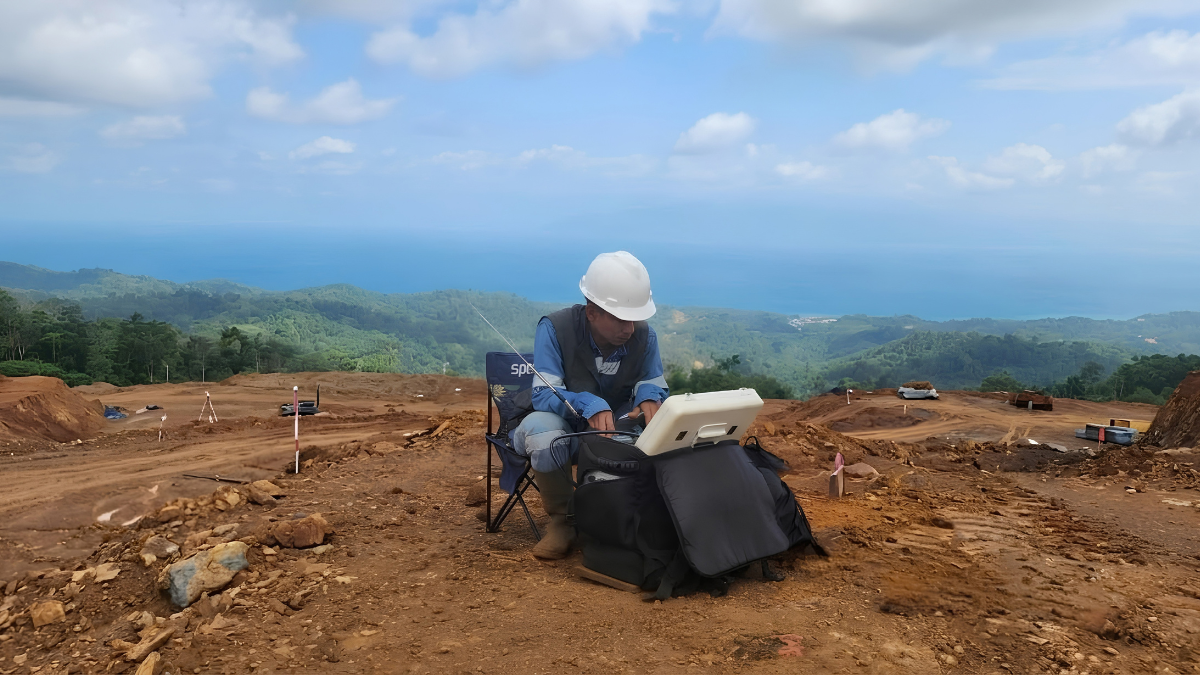
Selecting the right geophysical survey method is one of the most important decisions in any mineral exploration program. Before investing in drilling, exploration companies need reliable subsurface data to understand geological conditions, identify promising targets, and reduce exploration risk. Among the many geophysical techniques available today, two methods are frequently discussed for resistivity imaging: the CSAMT Survey and the Electrical Resistivity Tomography (ERT) Survey, commonly referred to as a resistivity survey.
Although both methods generate resistivity models of the subsurface, they are designed for different exploration objectives. Their operating principles, investigation depths, field procedures, and geological applications vary considerably. Understanding these differences helps exploration teams choose the method that best matches their project’s geological setting and exploration goals.
For mining projects in Indonesia, where exploration ranges from shallow nickel laterite deposits to deep porphyry copper-gold systems, choosing between a CSAMT Survey and an Electrical Resistivity Tomography (ERT) survey depends largely on the depth of the target and the type of geological information required.
This guide explains how both methods work, compares their strengths and limitations, and explores when each survey is the most effective choice for mineral exploration.
Understanding the Difference Between CSAMT Survey and Electrical Resistivity Tomography
One of the biggest misconceptions in geophysical exploration is that every “resistivity survey” refers to the same technology. In reality, Electrical Resistivity Tomography (ERT) and CSAMT Survey are based on different physical principles, even though both ultimately produce subsurface resistivity images.
Electrical Resistivity Tomography is a direct current (DC) geophysical method. During an ERT survey, electrical current is injected directly into the ground through electrodes, and the resulting voltage differences are measured to calculate subsurface resistivity. By repeating these measurements along a survey line, geophysicists generate detailed two-dimensional or three-dimensional images of near-surface geological conditions.
A CSAMT Survey, or Controlled Source Audio-frequency Magnetotellurics Survey, belongs to the electromagnetic (EM) family of geophysical methods. Instead of injecting current into the ground through electrodes, CSAMT uses a controlled electromagnetic transmitter located several kilometers away from the survey area. Receivers measure the electric and magnetic fields generated by the transmitted signal, allowing geophysicists to model underground resistivity at significantly greater depths.
While both techniques provide valuable geological information, they are designed to solve different exploration challenges.
How Electrical Resistivity Tomography (ERT) Works
Electrical Resistivity Tomography operates by placing multiple electrodes along the ground surface. A controlled electrical current is injected into the subsurface through selected electrodes, while other electrodes measure the resulting electrical potential.
By repeating thousands of measurements using different electrode combinations, specialized software reconstructs a detailed resistivity model of the subsurface.
Because the electrical current must physically travel through the ground, investigation depth depends heavily on electrode spacing and array configuration. Larger spacing allows deeper penetration but generally reduces image resolution.
As a result, ERT is best suited for shallow investigations, typically ranging from a few meters to several hundred meters depending on survey design. Its ability to produce high-resolution images makes it particularly valuable for mapping weathering profiles, shallow bedrock, groundwater systems, engineering sites, and near-surface geological structures.
How a CSAMT Survey Works
A CSAMT Survey uses a different approach. Instead of injecting electrical current directly into the ground, a transmitter generates controlled electromagnetic waves across a range of audio frequencies. These electromagnetic signals travel through the earth and interact with underground geological formations according to their electrical resistivity.
Receivers placed along survey lines measure both the electric field and magnetic field generated by the transmitted signal. After processing and inversion, geophysicists obtain two-dimensional or three-dimensional resistivity models that reveal geological structures beneath the surface. Because lower frequencies penetrate deeper into the ground, a CSAMT Survey can typically investigate from several tens of meters to approximately 1-2 kilometers, depending on geology, transmitter power, and survey configuration.
This makes CSAMT particularly valuable for mineral exploration where economically significant targets often occur well below the practical investigation depth of conventional resistivity surveys.
CSAMT Survey vs Electrical Resistivity Tomography: Key Differences
Although both methods produce resistivity images, their capabilities differ considerably.
| Comparison | CSAMT Survey | Electrical Resistivity Tomography (ERT) |
| Survey principle | Electromagnetic (EM) | Direct Current (DC) |
| Signal source | Controlled electromagnetic transmitter | Electrical current injected through electrodes |
| Investigation depth | Tens of meters to approximately 1-2 km | Typically tens to several hundred meters |
| Resolution | High at shallow to intermediate depths | Very high at shallow depths |
| Survey coverage | Large exploration areas | Smaller localized investigation areas |
| Typical application | Deep mineral exploration | Shallow geological investigations |
Rather than asking which method is better, exploration teams should ask which method best answers their specific geological questions.
Why Electrical Resistivity Tomography Is Widely Used for Nickel Exploration
Indonesia is the world’s largest nickel producer, and Electrical Resistivity Tomography has become an important exploration tool for laterite nickel deposits. Unlike porphyry copper or epithermal gold systems, nickel laterite deposits form close to the surface through tropical weathering of ultramafic rocks. These deposits typically consist of distinct layers including topsoil, limonite, saprolite, saprock, and fresh bedrock.
Each of these horizons exhibits different resistivity characteristics, allowing ERT to distinguish the boundaries between them. Several Indonesian studies demonstrate the effectiveness of Electrical Resistivity Tomography for nickel exploration. Research conducted in Southeast Sulawesi integrated multiple ERT survey lines with drillhole information to improve delineation of laterite horizons and bedrock geometry. Similar studies in Bahodopi, Central Sulawesi, validated ERT interpretations using hundreds of drillholes, confirming its effectiveness for mapping laterite profiles before resource modeling. [1]
These examples illustrate why ERT has become a preferred geophysical method for shallow nickel laterite exploration throughout Indonesia.
Why CSAMT Survey Is Better Suited for Deep Mineral Exploration
While ERT performs exceptionally well for shallow investigations, many economically significant mineral deposits occur much deeper underground. Porphyry copper-gold systems, epithermal gold deposits, structurally controlled sulfide mineralization, and hydrothermal alteration zones often extend hundreds or even thousands of meters beneath the surface. A CSAMT Survey was specifically developed to bridge the gap between shallow resistivity methods and deep Magnetotelluric (MT) surveys by providing high-resolution resistivity imaging at intermediate depths. For mineral exploration, this additional depth is critical.
Rather than focusing on weathering profiles, CSAMT helps geologists identify geological structures such as major faults, fracture systems, intrusive contacts, hydrothermal alteration halos, and conductive sulfide zones that may indicate favorable exploration targets. In Indonesia, CSAMT has been successfully applied in gold exploration projects, including studies in West Java where researchers combined CSAMT with Induced Polarization (IP) surveys to map silicification, breccia zones, and intrusive bodies associated with gold mineralization. [2]
Choosing the Right Survey for Indonesian Exploration Projects
Indonesia presents unique exploration challenges. The country lies within the Pacific Ring of Fire, where volcanic activity and tectonic processes have created diverse mineral systems including nickel laterites, porphyry copper-gold deposits, epithermal gold systems, and geothermal reservoirs. Because exploration targets vary significantly, no single geophysical method is suitable for every project.
Electrical Resistivity Tomography is often the preferred solution for projects investigating shallow geological conditions, especially nickel laterite deposits where the objective is to define weathering profiles, estimate bedrock depth, and optimize drilling within relatively shallow horizons. A CSAMT Survey, however, becomes increasingly valuable when exploration targets extend deeper beneath weathered cover or when structural interpretation plays a major role in understanding mineralization.
Exploration teams working on gold, copper, polymetallic, or geothermal projects frequently require information that lies well beyond the practical investigation depth of ERT, making CSAMT a more appropriate choice.
Can CSAMT Survey and ERT Be Used Together?
Absolutely. Modern exploration programs often integrate multiple geophysical methods because each provides different information about the subsurface. A common exploration workflow may begin with geological mapping and remote sensing, followed by a CSAMT Survey to image deeper geological structures and identify potential mineralized zones.
Electrical Resistivity Tomography can then be applied in selected areas to investigate shallow geological conditions with greater detail before drilling begins. By combining both methods with geological mapping, geochemical analysis, Induced Polarization surveys, and diamond drilling, exploration teams can develop a more complete understanding of the subsurface while reducing geological uncertainty. Rather than competing technologies, CSAMT and ERT often complement one another throughout different stages of mineral exploration.
How Puncakbaru Jayatama Supports Mineral Exploration
Every exploration project has different geological objectives, making survey selection, equipment, and acquisition design important parts of exploration planning.
At Puncakbaru Jayatama (PTPJ), CSAMT Survey services use Zonge instrumentation for mineral exploration and geotechnical assessment, providing reliable subsurface resistivity data to support geological interpretation, structural mapping, and drill target generation. The system is suitable for projects where understanding subsurface conditions at shallow to intermediate depths is critical to exploration decision-making.
By integrating CSAMT data with geological mapping, drilling programs, geochemical investigations, and other geophysical methods, exploration teams can develop a more comprehensive understanding of subsurface conditions, make more informed decisions, and improve confidence before committing to major drilling investments.
Because every exploration project is unique, survey planning, Zonge instrumentation configuration, acquisition parameters, and interpretation should always be tailored to the project’s geological setting, site conditions, and exploration objectives.
Frequently Asked Questions
Is a CSAMT Survey the same as an Electrical Resistivity Tomography survey?
No. Although both methods generate resistivity models, a CSAMT Survey uses controlled electromagnetic signals, while Electrical Resistivity Tomography injects direct electrical current into the ground through electrodes.
Which method investigates deeper underground?
A CSAMT Survey typically investigates much deeper than Electrical Resistivity Tomography, often reaching approximately 1-2 kilometers depending on geological conditions and survey design.
Which survey is better for nickel exploration?
For shallow nickel laterite exploration, Electrical Resistivity Tomography is often the preferred method because it provides highly detailed images of laterite horizons, saprolite, and bedrock geometry.
Which survey is better for gold or copper exploration?
For many gold and copper exploration projects, a CSAMT Survey is generally more suitable because it can image deeper geological structures associated with mineralization, including faults, hydrothermal alteration zones, and intrusive bodies.
Can both methods be used in one exploration project?
Yes. Many exploration programs combine Electrical Resistivity Tomography and CSAMT Survey to obtain detailed information from both shallow and deeper subsurface conditions.
Conclusion
Both Electrical Resistivity Tomography and CSAMT Survey are valuable geophysical methods, but they are designed for different exploration objectives. Electrical Resistivity Tomography excels at high-resolution imaging of shallow geological conditions and has become an important tool for nickel laterite exploration across Indonesia. Its ability to map weathering profiles, bedrock surfaces, and near-surface structures makes it highly effective for projects where exploration targets occur close to the surface.
A CSAMT Survey, however, offers significant advantages for deep mineral exploration. By imaging geological structures hundreds of meters to several kilometers beneath the surface, it helps exploration teams identify faults, hydrothermal alteration, intrusive contacts, and other features associated with economically significant mineral deposits. Rather than choosing one method over the other, the most effective exploration strategy is to select the survey that best matches the geological target or combine multiple methods to develop a more comprehensive understanding of the subsurface.
Strengthen Your Exploration Strategy with PTPJ’s CSAMT Survey Services
If your exploration project requires deeper subsurface imaging to support mineral exploration and drill target generation, Puncakbaru Jayatama (PTPJ) provides professional CSAMT Survey services tailored to Indonesia’s diverse geological environments.
Our experienced team combines advanced geophysical technology with practical exploration expertise to help mining companies gain valuable geological insights before drilling. Contact PTPJ today to learn how a CSAMT Survey can support more confident and efficient exploration decisions.
Source:
[1] Ipho Amanah Pahlawantika, Y. Yatini, and Muhammad Arief Wicaksono, “Integration of Electrical Resistivity Tomography and Borehole Data for Mapping Laterite-Bedrock Boundaries in a Nickel Deposit, ‘PHO’ Block, Southeast Sulawesi,” Indonesian Journal of Applied Physics, vol. 15, no. 1 (2025). https://jurnal.uns.ac.id/ijap/article/view/93950.
[2] University of Lampung, “Identifikasi Zona Mineralisasi Emas Berdasarkan Data Controlled Source Audio-Frequency Magnetotellurics (CSAMT) dengan Data Pendukung Induced Polarization (IP) di Lapangan AU,” Repository Universitas Lampung. https://repository.lppm.unila.ac.id/18257/