
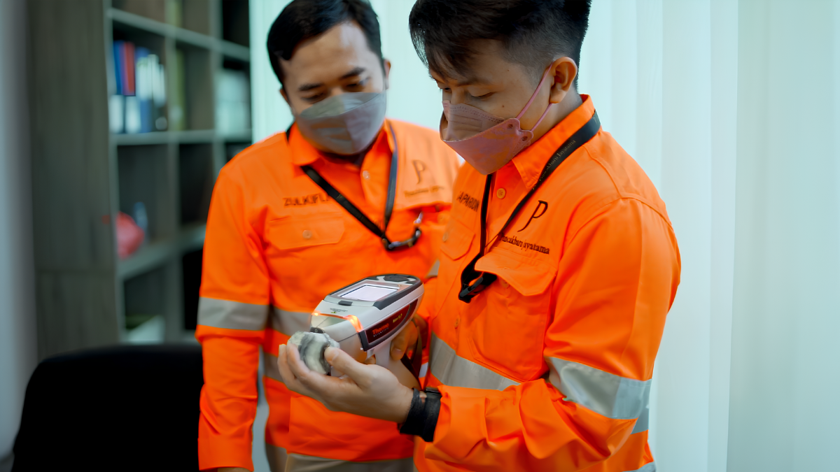
Before a mining project can progress toward resource development, mine planning, or investment decisions, a fundamental understanding of the geological environment is required. Exploration provides the information needed to determine the distribution, geometry, continuity, and characteristics of mineralization and to establish whether an area warrants further technical and economic evaluation.
This requires considerably more than a single geological survey or drilling campaign. Professional Geological Exploration Services encompass a coordinated range of geological, geochemical, geophysical, drilling, laboratory, and data-analysis activities. Each method contributes a different type of evidence, and the results are progressively integrated to develop and refine the geological interpretation of an exploration area.
Modern Exploration Mining is therefore a multidisciplinary process. Geological mapping establishes the surface geological framework, geochemical surveys characterize elemental distributions, geophysical methods investigate contrasts in subsurface physical properties, and exploration drilling provides direct geological information from depth. Laboratory analysis, quality assurance and quality control (QA/QC), GIS, and three-dimensional geological modelling then provide the basis for interpreting and managing the resulting datasets.
In Indonesia, exploration programs must also account for diverse geological environments, complex tectonic settings, tropical vegetation, mountainous terrain, variable accessibility, and climatic conditions. These factors influence the selection and implementation of exploration methods and require exploration programs to be designed according to the geological and operational characteristics of each project.
This article examines the principal components of Geological Exploration Services, their role within Exploration Mining, and the importance of integrating geological, geochemical, geophysical, drilling, and analytical information throughout the exploration process.
What Are Geological Exploration Services?
Geological Exploration Services comprise professional technical activities undertaken to investigate, characterize, and evaluate the geological and mineral potential of an area. Rather than referring to a single exploration technique, the term encompasses a range of investigations that may include geological mapping, geochemical sampling, remote sensing, geophysical surveying, exploration drilling, core logging, laboratory analysis, QA/QC, GIS, and geological modelling.
The principal objective of Exploration Mining is to progressively establish a geological understanding of an area through the acquisition and interpretation of reliable data. Early-stage information can be used to develop geological concepts and identify areas requiring further investigation, while subsequent exploration can provide increasingly detailed information about mineralization, structures, lithology, alteration, and subsurface geometry.
The specific combination of services varies according to the commodity, deposit model, geological setting, exploration stage, target characteristics, terrain, and project objectives. Consequently, exploration programs are normally designed around the geological questions that need to be addressed rather than based on a standardized package of techniques.
Why Geological Exploration Services Matter
Mineral exploration precedes many of the technical and economic decisions associated with a mining project. The geological information generated during exploration can contribute to target generation, drill planning, geological interpretation, resource estimation, and subsequent project evaluation. The quality and coverage of exploration data therefore have a direct bearing on the level of geological uncertainty that remains within a project. Well-designed Geological Exploration Services can provide information that supports:
- Geological interpretation and target generation.
- Characterization of mineralization and host-rock relationships.
- Exploration drilling design and prioritization.
- Geological and structural modelling.
- Mineral resource evaluation where sufficient data are available.
- Technical assessment and future project planning.
Exploration should not be regarded as a process that eliminates geological risk. Its role is to progressively reduce uncertainty by acquiring additional evidence and testing geological interpretations through appropriate investigation.
Core Components of Geological Exploration Services
Modern Exploration Mining typically combines several complementary disciplines. The relevance and sequence of each method depend on the geological setting and the objectives of the exploration program.
Geological Mapping and Investigation
Geological mapping provides the fundamental geological framework for exploration. Field geologists systematically document lithology, geological contacts, structural features, alteration, mineral occurrences, weathering characteristics, and other relevant surface expressions. Depending on the project, field programs may also incorporate structural measurements, outcrop characterization, rock-chip sampling, petrographic observations, and interpretation of existing geological information.
Structural geology is particularly important in many mineral systems because faults, fractures, folds, intrusive contacts, shear zones, and other structures can influence fluid movement and the distribution of mineralization. Although geological mapping primarily provides surface information, its interpretation establishes the geological context required to understand subsequent geochemical and geophysical results. For this reason, geological mapping remains a fundamental component of Geological Exploration Services and provides an important basis for developing and refining exploration models.
Geochemical Surveys
Geochemical exploration investigates the spatial distribution of elements within geological materials. Depending on the geological environment and exploration objective, samples may be collected from soil, rock, stream sediment, or other appropriate media. Laboratory analysis is then used to determine the concentrations of selected elements and, where appropriate, associated pathfinder elements.
Geochemical data can identify anomalous element distributions that warrant further investigation. Their interpretation may help delineate prospective areas or establish relationships between geochemical responses and geological features. However, the significance of a geochemical anomaly depends on its geological context. Elevated concentrations can have multiple causes, and an anomaly alone does not establish the presence, grade, continuity, or economic significance of mineralization. Geochemical results are therefore most effectively interpreted together with geological mapping, geophysics, drilling, and other available datasets.
Drone Magnetic Surveys
Drone Magnetic Surveys use unmanned aerial vehicles equipped with magnetometers to acquire measurements of variations in the Earth’s magnetic field across a defined survey area. Magnetic responses are related to variations in the magnetic properties of underlying geological materials. These measurements can provide information relevant to the interpretation of lithological boundaries, magnetic domains, structural trends, intrusive bodies, faults, and other geological features.
UAV-based magnetic acquisition can be particularly useful in areas where terrain or vegetation makes conventional ground surveying difficult or where detailed magnetic coverage is required. The quality and spatial resolution of a Drone Magnetic Survey depend on several factors, including sensor characteristics, flight altitude, line spacing, positioning, terrain clearance, magnetic interference, environmental conditions, and processing methodology. The resulting magnetic anomalies must therefore be interpreted within the geological framework. A magnetic response is an indication of a physical-property contrast and is not, by itself, confirmation of mineralization.
CSAMT Surveys
Controlled Source Audio-frequency Magnetotelluric (CSAMT) Surveys are electromagnetic geophysical investigations used to characterize variations in subsurface electrical resistivity. Different geological materials can exhibit different electrical properties. CSAMT measurements can therefore contribute to the interpretation of subsurface resistivity contrasts associated with lithological changes, geological structures, alteration, fluid-related systems, or other geological features. Depending on the geological environment and survey configuration, CSAMT may be applied to investigate:
- Fault and fracture systems.
- Resistivity contrasts between geological units.
- Alteration-related features.
- Subsurface geological boundaries.
- Structures that are not readily observable at the surface.
The depth of investigation, resolution, and interpretability of CSAMT data depend on survey design, electrode configuration, source characteristics, geological conditions, background noise, and other acquisition parameters. CSAMT should consequently be interpreted as one component of the geophysical and geological investigation rather than as a standalone indicator of mineralization. When combined with geological mapping and other geophysical or geochemical information, resistivity data can contribute to a more comprehensive interpretation of subsurface conditions.
Exploration Drilling
Exploration drilling provides direct physical information from beneath the surface and is generally undertaken when geological and exploration data indicate that subsurface investigation is warranted. Depending on the exploration objective, drilling programs may use Reverse Circulation (RC) drilling, diamond core drilling, or other appropriate drilling techniques.
Diamond drilling produces continuous cylindrical core that allows detailed observation of lithology, mineralization, alteration, structures, fractures, and rock characteristics. This makes diamond core particularly useful for detailed geological interpretation, structural analysis, geotechnical characterization, and applications where continuous core information is required.
RC drilling uses a different sampling approach and can be appropriate for exploration programs where rapid sample collection and particular drilling objectives are prioritized. The selection between drilling methods should be based on factors such as geological conditions, target depth, required sample information, drilling conditions, project stage, and overall exploration objectives. There is no single drilling method that is universally appropriate for every exploration program.
Geological Logging and Core Documentation
Drilling generates physical samples, but those samples must be systematically documented to become useful geological information. For diamond drilling, geologists typically record lithology, alteration, mineralization, structures, fractures, veins, recovery, rock-quality characteristics, and other relevant observations. Where appropriate, Rock Quality Designation (RQD) and other geotechnical parameters may also be recorded.
Consistent core logging establishes a structured dataset that allows geological characteristics to be compared between drillholes. These observations can subsequently be integrated with assay results, geophysical information, surface mapping, and structural interpretations. Core photography, sampling records, interval documentation, and appropriate chain-of-custody procedures can further contribute to effective drill-core management.
Laboratory Analysis and QA/QC
Laboratory analysis provides quantitative information about the chemical composition of exploration samples. Depending on the commodity and analytical requirements, exploration laboratories may apply methods such as:
- Fire assay.
- ICP-OES or ICP-MS multi-element analysis.
- XRF analysis.
- Mineralogical analysis.
- Metallurgical testing.
The appropriate analytical method depends on factors including sample type, target commodity, expected concentration range, detection limits, and project requirements.
Quality Assurance and Quality Control (QA/QC) procedures are an essential part of exploration data management. Exploration programs may incorporate certified reference materials, blanks, duplicate samples, laboratory checks, sample preparation controls, and data validation procedures. QA/QC does not guarantee that every analytical result is accurate, but it provides a framework for identifying potential sampling, preparation, analytical, or data-management issues. Reliable analytical data are particularly important when exploration results are subsequently used for geological interpretation and mineral resource estimation.
Geological Modelling and Resource Estimation
As exploration progresses, geological teams can integrate geological observations, geochemical results, geophysical data, drillhole information, and laboratory assays into geological models. Three-dimensional geological modelling can be used to represent lithological units, structural domains, interpreted mineralized zones, alteration, and other relevant geological relationships. Where sufficient drilling and sampling information are available, exploration results may contribute to a Mineral Resource estimate prepared under an appropriate reporting framework.
It is important to distinguish geological modelling from resource estimation. A geological model represents an interpretation of geological information, while a mineral resource estimate requires sufficient data density, appropriate estimation methodology, geological continuity, and consideration of the relevant reporting requirements. A Mineral Resource should also not be confused with a Mineral Reserve. A reserve represents the economically mineable portion of a measured and/or indicated mineral resource after consideration of relevant modifying factors.
Why Integrated Geological Exploration Services Matter
No single exploration method can characterize every aspect of a geological system. Geological mapping provides information about rocks and structures exposed at the surface. Geochemical surveys provide information about elemental distributions. Drone Magnetic Surveys characterize variations in magnetic properties. CSAMT provides information about subsurface resistivity. Drilling provides direct geological material from depth. Laboratory analysis provides quantitative chemical information, while geological modelling integrates these datasets spatially.
The value of an integrated exploration program lies in the ability to evaluate these different lines of evidence within a common geological framework. For example, a structural feature identified through geological mapping may coincide with a geophysical response and a geochemical anomaly. Such relationships can provide a basis for further investigation and target evaluation.
However, coincident anomalies do not automatically establish mineralization or economic potential. The observations must still be assessed against the geological model, data quality, deposit characteristics, and alternative interpretations. Integrated Exploration Mining is therefore best understood as a process of building, testing, and refining geological interpretations as additional evidence becomes available.
Geological Exploration Services in Indonesia
Indonesia contains a wide range of geological environments associated with commodities including nickel, copper, gold, tin, bauxite, and coal. The country’s position within the broader Pacific region and its complex geological history have contributed to diverse mineral systems across areas including Sulawesi, Maluku, Papua, Sumatra, Kalimantan, and Nusa Tenggara.
At the same time, Indonesian exploration projects can present significant operational challenges. Mountainous terrain, dense vegetation, tropical rainfall, remote locations, limited infrastructure, and variable ground conditions can affect geological mapping, geophysical acquisition, drilling access, logistics, and field scheduling. These conditions need to be considered during exploration planning. Survey design, equipment selection, access planning, drilling methodology, environmental considerations, and field logistics should be evaluated according to the specific characteristics of the project area.
Exploration activities must also comply with applicable Indonesian regulations, licensing requirements, environmental provisions, safety requirements, and relevant technical standards.
Selecting a Geological Exploration Services Provider
Selecting an exploration services provider should involve more than comparing individual technical capabilities. Project owners and exploration companies should evaluate whether a provider has the technical capacity and operational experience required for the specific project, including:
- Relevant geological and geophysical expertise.
- Appropriate survey and drilling capabilities.
- Experience with the applicable exploration environment.
- Established data acquisition and QA/QC procedures.
- Technical documentation and reporting capabilities.
- Appropriate health, safety, and environmental practices.
- Capacity to coordinate multiple exploration activities where required.
Technical capability is particularly important where several exploration disciplines need to be coordinated. Consistent communication between geological, geophysical, drilling, and data-management teams can help maintain continuity throughout an exploration program. Ultimately, the suitability of a provider should be assessed against the project’s geological objectives, technical requirements, operating environment, schedule, and scope of work.
How Puncakbaru Jayatama Supports Exploration Mining
Puncakbaru Jayatama (PTPJ) provides technical services for mineral exploration projects, with capabilities covering geological investigation, geophysical surveying, and exploration drilling. Its exploration-related services include geological consulting and mapping, Drone Magnetic Surveys, CSAMT Surveys, and professional diamond core drilling, depending on project requirements.
These services address different stages and aspects of exploration. Geological investigation can establish the surface geological framework, geophysical surveys can provide information about subsurface physical-property contrasts, and drilling can obtain direct geological information from depth.
The appropriate combination of services depends on the geological model, target characteristics, project stage, terrain, and information required to support the next exploration decision. PTPJ’s role is therefore not simply to provide individual field services, but to support exploration activities according to the technical requirements established for each project.
Frequently Asked Questions
What are Geological Exploration Services?
Geological Exploration Services are professional technical activities used to investigate and evaluate the geological and mineral potential of an area. Depending on the project, they may include geological mapping, geochemistry, geophysics, remote sensing, exploration drilling, core logging, laboratory analysis, QA/QC, GIS, and geological modelling.
Why are Geological Exploration Services important?
They provide the geological and technical information required to characterize an exploration area, evaluate targets, plan drilling, develop geological models, and support subsequent resource evaluation where sufficient data are available.
What is the difference between geological mapping and geophysical surveys?
Geological mapping primarily records rocks, structures, alteration, mineral occurrences, and other geological features observed at the surface. Geophysical surveys measure physical properties such as magnetism, electrical resistivity, density, or seismic response to provide information about subsurface conditions.
Why are Drone Magnetic Surveys used in mineral exploration?
Drone Magnetic Surveys measure variations in the Earth’s magnetic field and can contribute to the interpretation of lithological contrasts, magnetic domains, structural trends, intrusive bodies, and other geological features. Their results require appropriate processing and geological interpretation and do not directly confirm the presence of an economic mineral deposit.
What is CSAMT used for in mineral exploration?
CSAMT is an electromagnetic method used to characterize variations in subsurface electrical resistivity. Depending on the geological environment and survey design, the resulting data can contribute to the interpretation of geological units, structures, alteration-related features, and other subsurface resistivity contrasts.
Why is diamond core drilling used in mineral exploration?
Diamond core drilling produces continuous rock core that allows detailed examination of lithology, mineralization, alteration, structures, fractures, and rock characteristics. It is particularly useful when detailed geological or geotechnical information is required.
Should geological exploration services be integrated?
Integration can be valuable because different exploration methods provide different types of evidence. Geological, geochemical, geophysical, drilling, and laboratory information can be evaluated together to develop and refine geological interpretations and determine what additional investigation may be warranted.
Conclusion
Geological Exploration Services provide the technical foundation for understanding mineral potential before a project advances toward more detailed resource evaluation or development studies. Modern Exploration Mining combines multiple disciplines because no individual method can adequately characterize an entire geological system. Geological mapping establishes the surface framework, geochemistry examines elemental distributions, geophysical surveys investigate subsurface physical properties, and drilling provides direct geological evidence from depth.
The resulting samples and measurements then require systematic logging, laboratory analysis, QA/QC, data management, and geological interpretation. As datasets accumulate, geological modelling can provide a three-dimensional framework for understanding lithology, structures, and mineralized zones, while sufficiently supported exploration data may contribute to mineral resource estimation.
The effectiveness of an exploration program ultimately depends on the suitability of its methods, the quality of the data collected, the geological interpretation applied, and the way each stage of investigation informs the next. For projects in Indonesia, these technical considerations must be combined with practical factors such as terrain, accessibility, climate, logistics, regulatory requirements, safety, and environmental considerations.
A professional exploration program therefore begins with a clear geological objective and develops through progressively more detailed investigation. By selecting appropriate Geological Exploration Services and applying sound technical practices throughout the process, project owners and exploration teams can establish a stronger geological basis for evaluating mineral opportunities and planning subsequent stages of project development.
Explore Geological Exploration Services with PTPJ
Puncakbaru Jayatama (PTPJ) supports mineral exploration projects through geological investigation, Drone Magnetic Surveys, CSAMT Surveys, and professional diamond core drilling.
The appropriate exploration scope depends on the geological setting, exploration stage, target characteristics, and project objectives. PTPJ can support project-specific exploration requirements through technical services designed around these considerations.
For mining companies and exploration teams evaluating mineral prospects in Indonesia, establishing the right geological foundation is an essential first step toward making informed decisions throughout the exploration process.