
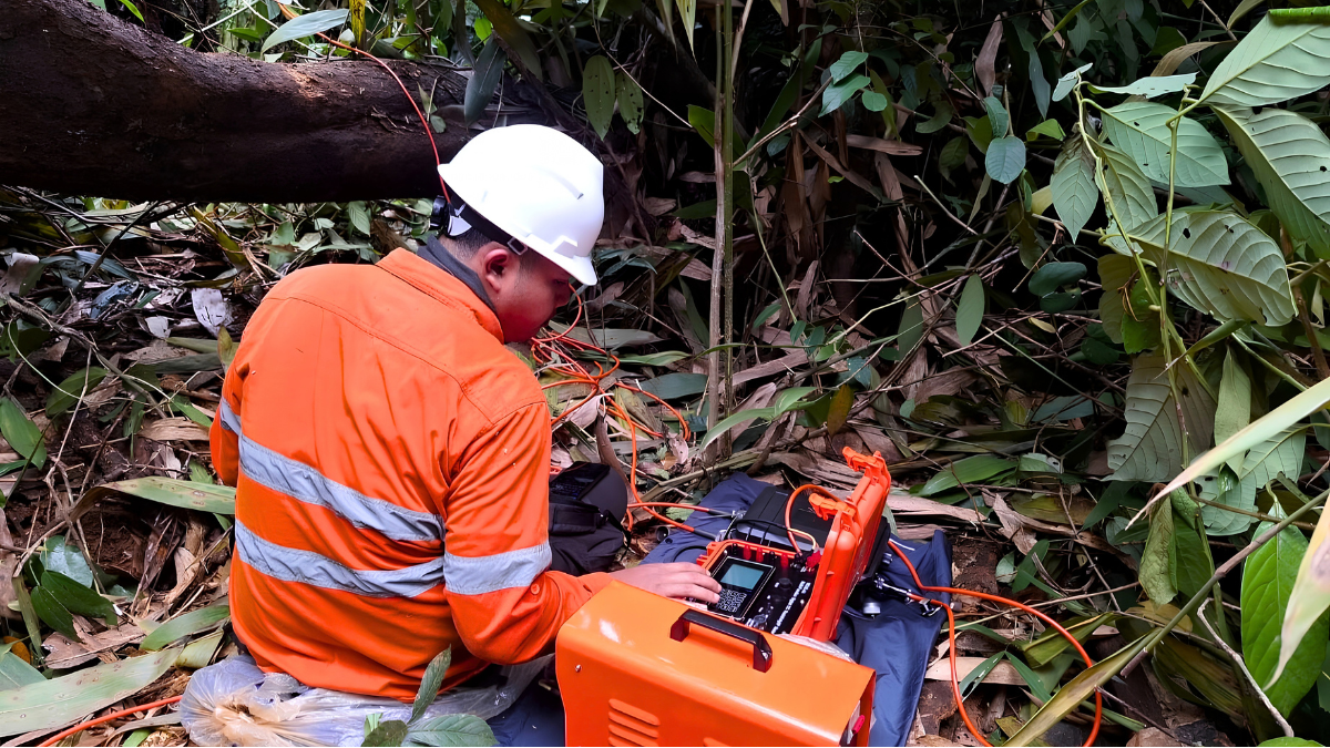
From the outside, drilling may appear to be a straightforward decision: identify an area that looks promising and place a drill rig there. In practice, drill targeting is usually the result of a much longer process involving geological observations, geochemical data, geophysical surveys, historical information, and technical interpretation.
Drilling is also a significant investment within many Exploration Mining programs. Equipment, field logistics, personnel, sample analysis, and geological interpretation all contribute to the cost of a drilling campaign. As a result, exploration teams generally seek to select drill locations that can test specific geological questions and provide useful information for the next stage of the program.
Modern mineral exploration therefore relies on integrating multiple sources of evidence rather than selecting drill locations from a single anomaly. This article explains how mining companies develop exploration targets, what information is considered before drilling, and how geological and geophysical data can contribute to drill planning.
Drilling Begins With a Geological Question
Exploration drilling is generally used to test a geological hypothesis. Before a drill rig arrives at a site, geologists may already have information from geological mapping, geochemical sampling, geophysical surveys, previous drilling, remote sensing, or historical exploration. The purpose of a drill hole may be to answer a specific question, such as:
- Does mineralization continue beneath a surface anomaly?
- Does a geological structure extend to depth?
- What is the relationship between two rock units?
- Does an alteration zone continue below the surface?
- Does an interpreted geophysical anomaly have a geological explanation?
- How does mineralization vary along or across a geological structure?
A drill hole can therefore provide value even when it does not intersect economic mineralization. The geological information obtained from an unsuccessful or unexpected result can be used to test and revise the existing geological model.
The Role of Exploration in Reducing Geological Uncertainty
Much of the geology relevant to mineral exploration is hidden beneath soil, vegetation, weathered material, or younger rock units. Exploration teams therefore build their understanding of the subsurface indirectly before drilling. Geological mapping provides surface observations, geochemical surveys provide information about elemental distributions, and geophysical methods measure physical properties that may vary below the surface.
The objective is not to remove geological uncertainty completely. Instead, exploration progressively adds information that can help determine which geological interpretations are more or less consistent with the available evidence. As new information becomes available, the geological model can be updated and exploration priorities can change.
Step 1: Understanding the Regional Geology
Drill targeting generally begins with an understanding of the broader geological setting. Exploration teams may review regional geological maps, historical exploration reports, satellite imagery, previous drilling records, government geological databases, academic publications, and other available information.
This information can help identify geological environments that may be relevant to the commodity being investigated. For example, certain mineral systems are associated with particular rock types, intrusive settings, structural environments, or tectonic histories.
Understanding these regional relationships provides a framework for deciding where more detailed investigation may be appropriate. However, regional geological characteristics alone are not sufficient to establish that mineralization is present at a particular location. They provide context for subsequent exploration work.
Step 2: Geological Mapping Provides Surface Evidence
After regional assessment, field geologists may conduct detailed geological mapping. Mapping can document:
- Rock types
- Lithological contacts
- Faults
- Fractures
- Folds
- Intrusive rocks
- Alteration
- Quartz veins
- Mineral occurrences
- Weathering characteristics
These observations help establish relationships between rock units and structures at the surface. Structural geology can be particularly relevant because mineralization in some geological systems is associated with faults, fractures, shear zones, intrusive contacts, or other structural features.
However, surface geology does not always represent the complete subsurface picture. Structures may change with depth, and geological units may be concealed beneath overburden or younger formations. For this reason, geological mapping is generally combined with other exploration methods when developing drill targets.
Step 3: Geochemical Surveys Identify Elemental Patterns
Geochemical surveys provide another source of evidence. Depending on the exploration environment, geologists may collect soil, stream sediment, rock, or other samples and analyze them for elements relevant to the exploration target. Elevated concentrations may form geochemical anomalies that warrant additional investigation.
However, a geochemical anomaly does not automatically indicate an economic mineral deposit. Element concentrations can be influenced by natural geological variation, weathering, groundwater movement, surface processes, and other factors.
Exploration teams therefore interpret geochemical results within their geological context. When a geochemical pattern is consistent with geological observations or other independent datasets, it may contribute to the development of a target hypothesis.
Step 4: Geophysical Surveys Provide Subsurface Information
Geophysical surveys can provide indirect information about geological conditions beneath the surface. Different methods measure different physical properties, so the appropriate technique depends on the geological question being investigated.
Drone Magnetic Surveys
A Drone Magnetic Survey measures variations in the Earth’s magnetic field using a magnetometer carried by a UAV. Magnetic contrasts can contribute to the interpretation of lithological boundaries, geological structures, intrusive bodies, magnetic units, and other features with different magnetic properties.
The lower survey altitude possible with some UAV systems can provide detailed spatial sampling over selected areas. However, the usefulness of the resulting data depends on the geology, target characteristics, survey altitude, line spacing, sensor performance, positioning, terrain, and data processing. A magnetic anomaly is therefore not automatically a drill target. Its significance needs to be evaluated alongside geological and other exploration information.
CSAMT Surveys
Controlled Source Audio-frequency Magnetotellurics (CSAMT) is an electromagnetic method that measures variations in subsurface electrical resistivity. Resistivity contrasts may provide information relevant to geological structures, lithological changes, alteration, fluids, or other subsurface features, depending on the geological environment.
CSAMT data can contribute to target evaluation when interpreted alongside geological, geochemical, drilling, and other geophysical information. As with magnetic surveys, a resistivity anomaly does not by itself establish the presence of mineralization.
Step 5: Integrating Multiple Sources of Evidence
One of the central principles of exploration targeting is the integration of multiple datasets. Exploration teams may consider:
- Regional geological information
- Detailed geological mapping
- Geochemical results
- Drone Magnetic Survey data
- CSAMT or other geophysical data
- Historical exploration records
- Previous drilling
- Remote sensing
- Existing geological models
These datasets can be brought together using GIS, geological modelling software, and other interpretation tools. The purpose is to determine whether different observations support a consistent geological interpretation.
For example, a structural feature identified through geological mapping may coincide with a geophysical anomaly and a geochemical response. This combination may provide a stronger basis for further investigation than any one dataset considered independently. However, different datasets can also produce conflicting interpretations. In those situations, geologists need to evaluate data quality, geological context, survey limitations, and alternative explanations before deciding whether a target warrants drilling.
Step 6: Ranking and Prioritizing Exploration Targets
Not every anomaly becomes a drill hole. Exploration teams generally prioritize targets according to the available evidence and practical project constraints. Factors may include:
- Geological setting
- Quality and consistency of supporting data
- Structural interpretation
- Geochemical response
- Geophysical characteristics
- Expected target depth
- Accessibility
- Terrain
- Environmental considerations
- Exploration objectives
- Available budget
Target ranking does not establish the probability of discovering an economic deposit. Instead, it helps exploration teams determine which geological hypotheses should be tested first or which areas require additional investigation before drilling. In some cases, additional surface work or geophysical surveying may be preferable to immediate drilling.
Step 7: Designing the Drill Hole
Selecting a target location is only one part of drill planning. The drill hole itself needs to be designed to address the geological question being tested. Important parameters can include:
- Drill collar location
- Azimuth
- Inclination
- Planned depth
- Hole spacing
- Target geometry
The planned orientation should account for the interpreted geometry of the target. For example, if mineralization is expected to follow a steeply dipping structure, the drill orientation may be selected to intersect that structure at an appropriate angle. Drill design may also need to consider terrain, access, environmental constraints, existing drillholes, and operational requirements.
Step 8: Diamond Core Drilling Tests the Geological Model
Once a drill target and drilling plan have been established, drilling provides direct subsurface information. Several drilling methods can be used in mineral exploration. Diamond core drilling is particularly useful when continuous rock samples are required for detailed geological investigation. Recovered core can provide information about:
- Lithology
- Mineralization
- Alteration
- Veins
- Faults
- Fractures
- Structural orientation
- Rock quality
- Geological contacts
The results can then be compared with the geological model used to develop the drill target. The purpose is not simply to confirm the original interpretation. Drill results can support the interpretation, modify it, or show that an alternative geological explanation needs to be considered.
What Happens When a Drill Hole Does Not Intersect Mineralization?
A drill hole that does not intersect the expected mineralization does not necessarily mean that the entire exploration concept has failed. The result provides information about the subsurface at the location and depth tested. For example, an unexpected result may indicate that:
- The target was deeper than expected
- The interpreted structure has a different orientation
- Mineralization is discontinuous
- The geophysical anomaly has another geological source
- The geological model needs to be revised
- Additional information is required before further drilling
Exploration is therefore an iterative process. A result that differs from expectations can lead to changes in the geological model, additional mapping, revised geophysical interpretation, or a different drilling strategy.
Exploration Targeting in Indonesia
Indonesia contains a wide range of geological environments associated with commodities such as gold, copper, nickel, tin, and other mineral resources. Exploration conditions can vary considerably between regions. Dense vegetation, rugged terrain, weather, remote locations, and limited infrastructure can make surface geological observation and field access challenging in some areas.
Indonesia’s complex tectonic and geological history can also result in complicated relationships between rock units, structures, alteration, and mineralization. Exploration programs may therefore combine geological mapping, geochemical surveys, geophysical methods, and drilling to develop and test geological interpretations. The specific combination of methods depends on the commodity, geological environment, project stage, available information, and exploration objectives.
How Puncakbaru Jayatama Supports Exploration Mining
At Puncakbaru Jayatama (PTPJ), exploration services can be developed around the geological objectives and technical requirements of each project. PTPJ can support exploration programs through geological consulting, Drone Magnetic Surveys, CSAMT Surveys, and professional diamond core drilling.
These services can contribute different types of information to the exploration process. Geophysical surveys can provide indirect information about subsurface physical properties, while drilling can provide direct geological samples for further analysis.
The appropriate combination of methods depends on the project. Some targets may require additional geological or geophysical investigation before drilling, while others may be suitable for direct testing through exploration drilling. PTPJ’s role is to support the collection, quality control, processing, and interpretation of exploration information so that geological decisions can be made using the available evidence.
Frequently Asked Questions
How do mining companies decide where to drill?
Mining companies generally consider multiple sources of information, including geological mapping, geochemical results, geophysical surveys, historical exploration data, previous drilling, and geological models. These datasets are interpreted together to identify and prioritize geological targets for further investigation.
What is an exploration target?
An exploration target is a geological interpretation or area considered worthy of additional investigation based on available evidence. It does not establish the presence, size, grade, or economic viability of a mineral deposit.
Why are geophysical surveys used before drilling?
Geophysical surveys can provide indirect information about subsurface physical properties that cannot be observed directly at the surface. This information can contribute to geological interpretation and target evaluation.
Why don’t mining companies drill every anomaly?
Not every anomaly represents mineralization. Anomalies can have multiple geological or non-geological explanations. Exploration teams therefore consider the quality and consistency of available evidence, target characteristics, technical feasibility, and project objectives before deciding whether to drill.
Why is diamond core drilling used in exploration?
Diamond core drilling recovers continuous rock samples that can preserve information about lithology, mineralization, alteration, structures, and rock quality. This makes it useful when detailed subsurface geological information is required.
What happens if a drill hole misses its target?
The result can provide information that helps refine the geological model. Depending on the findings, exploration teams may revise the target location, depth, orientation, or geological interpretation, or may decide that additional investigation is not warranted.
Conclusion
Mining companies generally do not select drill locations based on a single geological observation or geophysical anomaly. Drill targeting is usually a process of collecting and integrating evidence from multiple exploration methods.
Regional geology provides the broader geological framework. Geological mapping identifies surface relationships. Geochemistry provides information about elemental patterns. Geophysical surveys provide indirect information about subsurface physical properties. Drilling then provides direct geological evidence that can be compared with the existing interpretation.
The resulting process is iterative. Drill results can confirm an interpretation, challenge it, or lead to a revised geological model. For this reason, the purpose of exploration targeting is not to guarantee that a particular drill hole will intersect economic mineralization. Instead, it is to develop a reasoned geological hypothesis and determine whether drilling is an appropriate way to test it.
Support Your Exploration Program With PTPJ
Developing a drill program requires an understanding of the geological information already available and the questions that remain unanswered.
Puncakbaru Jayatama (PTPJ) supports mineral exploration through geological consulting, Drone Magnetic Surveys, CSAMT Surveys, and professional diamond core drilling.
If you are planning an exploration drilling program or evaluating potential drill targets, contact PTPJ to discuss your geological objectives, available data, and technical requirements.