
Mining is often associated with excavation, processing plants, and mineral production. However, before mining can begin, companies need to understand what mineral resources may be present, where they occur, and whether further investigation is justified.
This process is generally known as mineral exploration. It involves a range of geological, geochemical, geophysical, and drilling activities designed to investigate the subsurface and progressively develop an understanding of a potential mineral deposit.
The term Exploration Mining is sometimes used when discussing this stage of the mining industry, although mineral exploration is the more commonly used technical expression. Unlike mining, which focuses on extracting and processing mineral resources, exploration focuses on gathering information and reducing geological uncertainty before major development decisions are made.
Modern exploration can combine geological mapping, geochemical sampling, geophysical surveys, exploration drilling, laboratory analysis, and three-dimensional geological modelling. The specific combination depends on the commodity, geological setting, exploration stage, terrain, and information already available.
In countries such as Indonesia, exploration can involve a wide range of geological environments and operating conditions. Understanding these conditions is an important part of developing an appropriate exploration program.
What Is Exploration Mining?
Exploration Mining refers broadly to the activities undertaken to search for and evaluate potential mineral deposits before mining operations are established.
The main purpose of mineral exploration is to progressively improve the understanding of an area and determine whether additional investigation is warranted. Exploration teams may seek to answer questions such as:
- Are minerals of interest present in the area?
- Where are areas of potential mineralization located?
- What geological structures or rock units may be associated with the mineralization?
- How deep might the mineralized zones extend?
- What are the characteristics and distribution of the mineralization?
- Is there sufficient geological information to justify further evaluation?
These questions cannot usually be answered through a single survey or drilling program. Exploration is generally an iterative process in which information from one stage helps determine the next stage of investigation.
The results may eventually contribute to mineral resource estimation and economic studies, but exploration data alone do not establish whether a mining project will ultimately be economically viable.
Why Is Mineral Exploration Important?
Mining projects require substantial investment in exploration, studies, infrastructure, permitting, construction, processing, and operations. Before these later stages can be properly assessed, companies need a reasonable understanding of the geological setting and the mineralization being investigated.
Exploration helps build that understanding by progressively collecting geological evidence. Geological mapping can establish the surface framework, geochemical sampling can identify areas with anomalous element concentrations, and geophysical surveys can provide information about subsurface physical properties.
Exploration drilling then provides direct samples and observations from below the surface. Laboratory analysis adds information about mineral and elemental concentrations.Together, these datasets can support geological interpretation, target evaluation, resource modelling, and subsequent technical studies. The purpose is not to eliminate uncertainty completely,subsurface geology always contains uncertainty, but to improve the quality of information available for exploration and development decisions.
The Main Stages of the Exploration Process
There is no single exploration workflow that applies to every mineral project. However, exploration commonly progresses from broader and lower-cost investigations toward more detailed work as geological understanding improves.
1. Desktop Studies and Geological Research
Exploration often begins with existing information. Geologists may review geological maps, historical exploration reports, government datasets, academic publications, satellite imagery, previous drilling records, and other available information. The objective is to understand the regional geological setting and identify areas that may warrant field investigation. Desktop studies can also help exploration teams identify gaps in existing information and develop an initial exploration strategy.
2. Geological Mapping
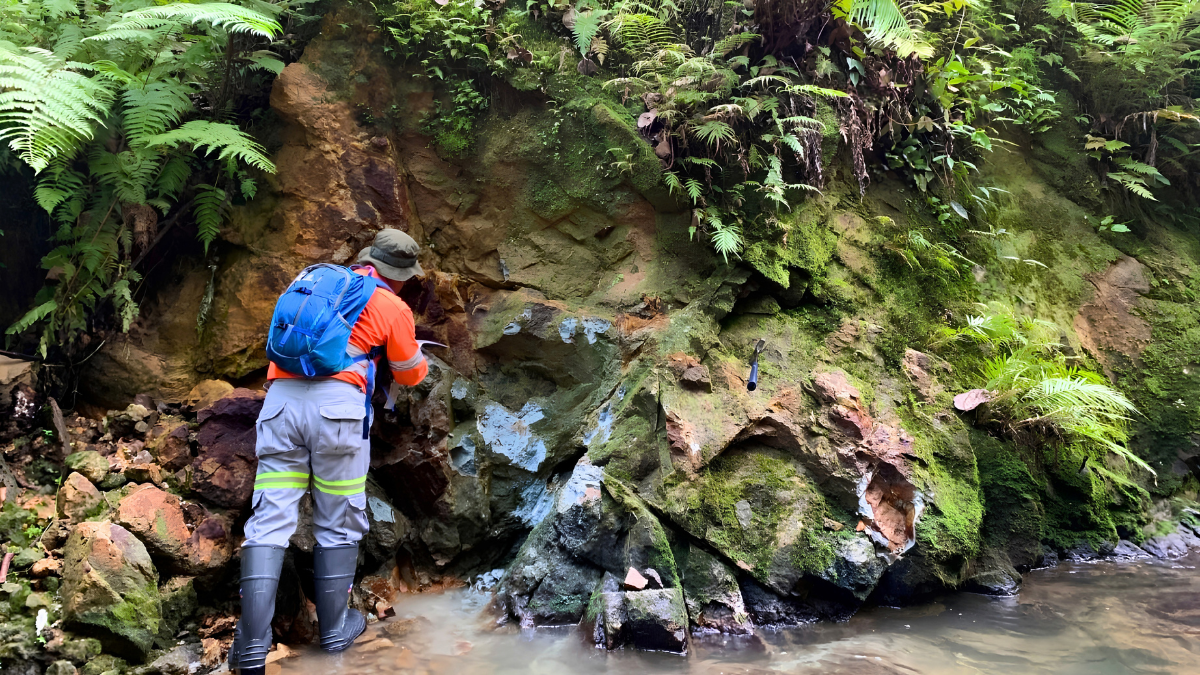
Field geological mapping provides direct observations of rocks and geological structures at the surface. Geologists may document:
- Rock types and lithological contacts
- Faults and fractures
- Structural trends
- Alteration
- Mineral occurrences
- Weathering
- Outcrop distribution
Mapping helps establish a geological framework for interpreting other exploration datasets. In areas with limited outcrop, geological interpretation may also incorporate remote sensing, historical information, and geophysical data.
3. Geochemical Sampling
Geochemical exploration involves collecting and analyzing samples to identify variations in the concentration of elements of interest. Depending on the geological environment and exploration objective, samples may include soil, stream sediment, rock, or other materials.
An anomalous geochemical result may indicate an area that warrants further investigation, but an anomaly does not automatically represent an economic mineral deposit. Geochemical results need to be interpreted within their geological and environmental context. Sampling methodology, sample preparation, laboratory procedures, quality control, and data interpretation are all important considerations when using geochemistry in exploration.
4. Geophysical Surveys
Geophysical surveys provide indirect information about subsurface physical properties. Different geophysical methods respond to different properties of geological materials. As a result, the appropriate method depends on the exploration question.
For example, a Drone Magnetic Survey measures variations in the Earth’s magnetic field and can contribute to geological and structural interpretation. In suitable settings, magnetic data may help identify contrasts between rock units or investigate magnetic anomalies.
CSAMT Surveys measure electrical resistivity characteristics and can provide information about subsurface variations that may be relevant to geological structures, alteration, or other exploration targets. Other methods, including Induced Polarization (IP), Electrical Resistivity Tomography (ERT), gravity, electromagnetic surveys, and ground magnetic surveys, may also be considered depending on the project.
Geophysical surveys do not directly provide a complete image of the subsurface. Instead, they provide measurements that require geological interpretation and, where appropriate, integration with other exploration data.
5. Exploration Drilling
Drilling provides direct information about subsurface geology. Two commonly used approaches include Reverse Circulation (RC) drilling and diamond core drilling. The appropriate drilling method depends on the exploration stage, geological objectives, ground conditions, sample requirements, and project specifications.
Diamond drilling produces a continuous core sample that can preserve information about lithology, structures, alteration, mineralization, and rock quality. RC drilling can provide efficient sample recovery for many exploration applications and can be useful where the objective and geological conditions are appropriate. Neither drilling method is universally preferable. The choice should reflect the information required by the exploration program.
6. Laboratory Analysis and Geological Evaluation
Samples obtained during exploration are analyzed to determine the concentrations of elements or other characteristics relevant to the project. Laboratory results are combined with geological logging, structural information, geophysical interpretation, and drilling data to develop a more comprehensive understanding of the mineralized system. As exploration progresses, the information may be incorporated into geological and three-dimensional models.
Where sufficient data are available, these models can support mineral resource estimation and subsequent technical or economic studies. Resource estimates require appropriate sampling, geological interpretation, estimation methods, quality control, and reporting practices. Recognized reporting frameworks within the CRIRSCO family provide principles and standards for reporting mineral resources and reserves, reinforcing the importance of transparent and properly documented geological information.
Greenfield vs. Brownfield Exploration
Exploration projects can be broadly categorized according to their existing level of development and geological information.
Greenfield Exploration
Greenfield exploration takes place in areas where there may be limited previous exploration or mining activity. Because less information is available, geological uncertainty can be relatively high. Exploration teams may therefore begin with regional geological research, remote sensing, geochemical surveys, and geophysical investigations before selecting areas for more detailed work. The exploration approach depends strongly on the geological setting and the availability of historical information.
Brownfield Exploration
Brownfield exploration takes place around or near an existing mine, known deposit, or previously explored area. Existing drilling, geological models, production information, and other datasets may provide a starting point for further investigation. Objectives can include investigating extensions of known mineralization, testing geological interpretations, or evaluating areas adjacent to an existing operation. The distinction between greenfield and brownfield exploration is useful because the available information and exploration objectives can be substantially different.
The Role of Technology in Modern Mineral Exploration
Technology has expanded the range of tools available to exploration teams. Modern programs may integrate:
- Drone Magnetic Surveys
- CSAMT and other electrical or electromagnetic methods
- GIS and spatial databases
- GPS and RTK positioning
- Remote sensing
- Three-dimensional geological modelling
- Digital geological and core logging
- Geochemical data analysis
These technologies do not replace geological expertise. Instead, they provide additional information that can help geologists investigate geological relationships and prioritize areas for further work. The most appropriate technology depends on the exploration objective. A method that is useful for one geological environment may provide limited information in another.
Exploration Mining in Indonesia
Indonesia contains a diverse range of geological environments associated with mineral resources including nickel, gold, copper, tin, bauxite, and other commodities. The country’s geology includes volcanic arcs, intrusive systems, sedimentary basins, ophiolitic terrains, and structurally complex regions. These environments can present both exploration opportunities and technical challenges.
Exploration programs in Indonesia may therefore involve a combination of geological mapping, geochemistry, geophysics, drilling, and laboratory analysis. Terrain and logistics can also influence exploration planning. Dense vegetation, mountainous areas, remote locations, weather conditions, and limited infrastructure may affect how field programs are designed and executed.
Exploration activities must also account for applicable Indonesian regulations, licensing requirements, environmental considerations, land access, and operational requirements.
Common Challenges in Mineral Exploration
Mineral exploration is inherently uncertain because much of the geological information being sought lies beneath the surface. Several factors can make exploration particularly challenging.
Limited Surface Exposure
Weathering, soil, vegetation, and other surface conditions can obscure underlying geology. In such environments, geophysics and drilling may provide additional information that cannot be obtained from surface mapping alone.
Complex Geology
Multiple geological events can produce complex relationships between rock units, structures, alteration, and mineralization. Interpreting these relationships often requires integrating multiple datasets rather than relying on one exploration method.
Difficult Terrain and Logistics
Exploration programs may operate in mountainous, forested, remote, or otherwise difficult environments. Access, transportation, accommodation, communications, equipment mobilization, and weather can all influence the timing and cost of field activities.
Uncertainty in Subsurface Interpretation
Geophysical anomalies, geochemical anomalies, and geological indicators are not necessarily direct evidence of an economic mineral deposit. Exploration teams must therefore continually test interpretations against new evidence from mapping, sampling, drilling, and laboratory analysis.
Why Exploration Uses Multiple Methods
One of the most important principles in modern mineral exploration is that different methods provide different types of information. Geological mapping describes observed rocks and structures. Geochemistry measures elemental concentrations in samples. Geophysics provides indirect information about physical properties beneath the surface. Drilling provides direct subsurface samples and geological observations. Laboratory analysis provides quantitative information about the samples.
When these datasets are integrated, exploration teams can develop a more comprehensive geological interpretation than would generally be possible from any single method. This does not eliminate uncertainty, but it can provide a stronger basis for deciding where additional work may be appropriate.
How Puncakbaru Jayatama Supports Mineral Exploration
At Puncakbaru Jayatama (PTPJ), exploration services can be integrated according to the geological and technical requirements of each project. PTPJ supports exploration activities that may include geological consulting, geophysical surveys, and professional diamond core drilling.
Geophysical services can include methods such as Drone Magnetic Surveys and CSAMT Surveys, depending on the project’s objectives and geological setting. Drilling can then provide direct subsurface information that can be integrated with geological and geophysical results.
Rather than assuming that a particular exploration method is suitable for every project, survey and drilling programs can be developed around the information that needs to be obtained. This integrated approach allows exploration teams to progressively build their geological understanding and use new information to guide subsequent investigation.
Frequently Asked Questions
What is Exploration Mining?
Exploration Mining is a general term for activities involved in searching for and evaluating mineral deposits before mining. The more commonly used technical term is mineral exploration, which includes geological, geochemical, geophysical, drilling, and laboratory investigations.
Why is mineral exploration important?
Mineral exploration provides geological information that can help companies evaluate areas of mineral potential, investigate mineralization, and determine whether additional technical or economic evaluation is warranted.
What happens before exploration drilling?
Exploration teams may conduct desktop studies, geological mapping, geochemical sampling, remote sensing, and geophysical surveys before drilling. The exact sequence depends on the project and available information.
What methods are commonly used in mineral exploration?
Common methods include geological mapping, geochemical sampling, geophysical surveys, exploration drilling, laboratory analysis, and geological modelling. The combination varies according to the commodity, geology, terrain, and exploration stage.
Why is diamond core drilling used in mineral exploration?
Diamond drilling produces continuous core samples that can provide detailed information about lithology, structures, alteration, mineralization, and rock quality. This makes it useful for geological interpretation and, where appropriate, resource evaluation.
Does exploration guarantee the discovery of an economic mineral deposit?
No. Exploration is a process of reducing geological uncertainty and evaluating mineral potential. Even extensive exploration does not guarantee the discovery of an economically viable deposit.
How long does mineral exploration take?
There is no standard exploration timeline. A project may progress through several stages over months or years depending on its size, geological complexity, regulatory requirements, exploration results, funding, and development objectives.
Conclusion
Mineral exploration is an investigative process that takes place before and during the evaluation of potential mining projects. It combines geological observations, geochemical analysis, geophysical measurements, drilling, laboratory testing, and modelling to progressively improve understanding of the subsurface.
The term Exploration Mining may be used when discussing this stage of the mining industry, but mineral exploration is the more precise technical term.
No single exploration method can answer every geological question. Geological mapping, geochemistry, geophysics, drilling, and laboratory analysis each provide different types of information. Their value often comes from how they are integrated into a broader exploration program.
For exploration companies, the objective is not simply to collect more data, but to collect the right data for the geological question being investigated. As new information becomes available, exploration programs can be refined and additional work can be planned where justified.
Discuss Your Mineral Exploration Requirements With PTPJ
PT Puncakbaru Jayatama (PTPJ) supports mineral exploration projects through geological consulting, geophysical survey services, and professional drilling.
Depending on project requirements, PTPJ can support exploration programs involving Drone Magnetic Surveys, CSAMT Surveys, diamond core drilling, and related geological activities.
If you are evaluating a new exploration area or planning additional work on an existing prospect, contact PTPJ to discuss the geological objectives, available data, and exploration requirements for your project.